Spatial Data Science Masters Program
Solving data-intensive, large-scale, location-based problems
Geospatial data accessibility, spatial decision support systems, and geospatial problem-solving environments are revolutionizing most industries and disciplines. Career opportunities abound in health care, marketing, social services, human security, education, environmental sustainability, transportation and more. To solve data-intensive, large-scale, location-based problems, spatial data science professionals draw upon engineering, computer science, math and spatial science principles offered in data science master's programs.
Applications for Spring 2024:
- Opens on Wednesday, August 2, 2023.
- The deadline to apply is Friday, November 3, 2023.
Applications for Fall 2024:
- Opens on Monday, January 1, 2024.
- The deadline to apply is Friday, June 7, 2024.
Apply here
Career Opportunities in Spatial Data Science
Glassdoor users rated "data scientist" as the most satisfying job in the “Data Science and Business Analytics” field; with an average base pay of $121,000/year and 4,100+ openings.
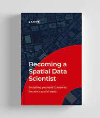
Read Carto's "Becoming a Spatial Data Scientist" for insights into this emerging role.
As an example of the growing importance of a data science degree, the Southern California Association of Governments (SCAG) is hosting data science students from regional universities to support a new region-wide initiative around open and big data in the coming years. Through a generous contribution by Randall Lewis, the fellows selected will play an important role in supporting governments across the region to become more data-driven and effective in the provision of their services. For more information about the Randall Lewis Data Science Fellowship, click here.
Scientific Applications Software Engineer, Suborbital Radar Science and Engineering Group, NASA Jet Propulsion Laboratory
"A program that uniquely combines computer science with GIS"
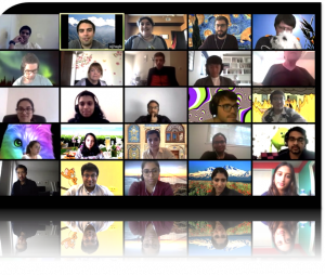
Meet Students and Alumni of our Spatial Data Science Masters Program


The USC Masters in Spatial Data Science program provides students with the knowledge and skills to:
- Understand and contribute toward the significant technical and societal challenges created by large location-based data environments, including architecture, security, integrity, management, and scalability;
- Understand how spatial data can be acquired and used to support various forms of analysis, modeling, and geo-visualization in large data environments; and
- Understand how artificial intelligence, machine learning, and data mining can be used to augment the typical geographic information science (GIS) concepts and workflows to intelligently mine data to provide enterprise-centric solutions for a variety of societal challenges and issues spanning the public, private and not-for-profit sectors.
Upon graduation, students will have data science skills and will be uniquely qualified to lead data science teams in companies and organizations working with geolocated information, conducting data analytics in startups and tech companies with location-based data, and using emerging technologies with spatial data.
Students complete a core set of courses to provide a foundation in information engineering, spatial analysis and thinking with their choice of electives to optimize their preparation for their preferred career path and unique professional opportunities.
Students will understand the overall field of data science, the role of the analyst and/or data scientist, and the domains where spatial data science skills can be applied to critical organization missions. They will understand how data management, data visualization, and artificial intelligence techniques (specifically data mining and machine learning) are critical to the spatial analysis process and how these can be applied to real-world challenges. Throughout their course work, students will assemble a digital portfolio that is intended to help them demonstrate their capabilities and skills for the job market.
"The importance of learning spatial data problem-solving"
Curriculum8 required courses (32 units total).
A minimum cumulative GPA of 3.00 is required for graduation.Year 1Semester 1:Introduction to data analysis techniques and associated computing concepts for non-programmers. Topics include foundations for data analysis, visualization, parallel processing, metadata, provenance, and data stewardship.The unique characteristics and importance of spatial information as they relate to the evolving science, technology, and applications of Geographic Information Systems.Semester 2:Programming in Python for retrieving, searching, and analyzing data from the Web. Programming in Java. Learning to manipulate large data sets.Design, coding, and implementation of GIS-based software and models using the Python programming language. Recommended preparation: SSCI 581.Year 2Semester 3:Fundamentals of big data informatics techniques. Data lifecycle; the data scientist; machine learning; data mining; NoSQL databases; tools for storage/processing/analytics of large data set on clusters; in-data techniques.
Recommended Preparation: Basic understanding of engineering and/or technology principles; basic programming skills; background in probability, statistics, linear algebra and machine learning.Introduction to the spatial data scientific approach to issues and a holistic generalizable analysis pipeline.Semester 4:Data Science Elective Courses: (Choose one course for 4 units)
Techniques to efficiently store, manipulate, index and query geospatial information in support of real-world geographical and decision-making applications. Note: SSCI 582 meets the CSCI 585 prerequisite for CSCI 587 and must be taken before it.Function and design of modern storage systems, including cloud; data management techniques; data modeling; network attached storage, clusters and data centers; relational databases; the map-reduce paradigm. Recommended preparation: DSCI 550 taken previously or concurrently; understanding of operating systems, networks, and databases; experience with probability, statistics, and programming.Practical applications of machine learning techniques to real-world problems. Uses in data mining and recommendation systems and for building adaptive user interfaces. Recommended preparation: DSCI 550 and DSCI 551 taken previously or concurrently; knowledge of statistics and linear algebra; programming experience.Graphical depictions of data for communication, analysis, and decision support. Cognitive processing and perception of visual data and visualizations. Designing effective visualizations. Implementing interactive visualizations.Understand and apply user interface theory and techniques to design, build and test responsive applications that run on mobile devices and/or desktops. Recommended preparation: Knowledge of data management, machine learning, data mining, and data visualization.Student teams working on external customer data analytic challenges; project/presentation based; real client data, and implementable solutions for delivery to actual stakeholders; capstone to degree. Recommended Preparation: Knowledge of data management, machine learning, data mining, and data visualization.
Spatial Elective Courses: (Choose one course for 4 units)
Design, implementation, and interrogation of relational, object-oriented and other types of geospatial databases. Recommended preparation: SSCI 581.The use of spatial models to describe social and environmental processes, patterns and systems at multiple spatial and temporal scales. Recommended preparation: SSCI 583.Design and implementation of locally served and cloud-based geospatial web applications. Construction of web maps, mashups and Volunteered Geographic Information interfaces. Recommended preparation: SSCI 581.Requirements for graduation, course offerings, course availability, track offerings and any other data science degree requirements are subject to change. Students should consult with an academic advisor in the Viterbi School of Engineering or in the Spatial Sciences Institute prior to registering for any classes.
An Interdisciplinary Program
The USC Masters in Spatial Data Science is a joint data science degree program offered by the Viterbi School of Engineering and the Dornsife College of Letters, Arts and Sciences. Applicants make one application to the program and admissions decisions are made jointly by the Viterbi School of Engineering Department of Computer Science and the Dornsife College of Letters, Arts and Sciences Spatial Sciences Institute. Spatial Data Sciences students benefit from being students in both USC Viterbi and USC Dornsife.
CKIDS and Data Fest
 The USC Center for Knowledge-Powered Interdisciplinary Data Science (CKIDS) provides opportunities to get involved in collaborative data science projects with other faculty and students across the university and with data science students in training.
Since 2019 faculty members from across the university have been collaborating through CKIDS to work on joint projects through DataFest events. In these events, faculty and senior researchers tackle new interdisciplinary topics and engage students in data science, computer science and other disciplines to work together to formulate interesting problems and define joint approaches to solve them. See examples of projects from the Spring 2020 semester.
Learn more about upcoming Data Fest and other CKIDS data science events here.
- An undergraduate degree in STEM (science, technology, engineering, and math) or related social science from a regionally-accredited university.
- Satisfactory cumulative undergraduate GPA (grade point average), minimum 3.0.
Competitive applicants will have programming experience, or a quantitative background, or at least a year of calculus.
The curriculum is designed to be accessible to students with any background, including students with a spatial sciences background and no computer science knowledge as well as students with a computer science background and no spatial sciences knowledge.
Students must be admitted in an admissions process coordinated by both the Viterbi School of Engineering and the Dornsife College of Letters, Arts and Sciences. Applications are accepted for admissions in the fall and spring semesters.
Spatial Data Science Program Application Materials
- All applicants must complete and submit the USC Online Application.
- Official Transcripts: Official transcripts from all colleges and universities attended, sealed by the institution. Mail transcripts to: USC Graduate Office of Admission University Park Campus Los Angeles, CA 90089-0915. If sending via a private carrier (e.g., UPS, FedEx, or DHL), send transcripts to: University of Southern California Office of Admission & Financial Aid 3601 South Flower Street Tyler 1 Los Angeles, CA 90089-0915. For more information regarding transcripts visit the USC Graduate Admissions Office - Transcript Requirements.
- GRE General Test: The GRE will no longer be required starting with the Fall 2022 applications. Satisfactory scores must be less than five years old. Official scores must be reported from ETS directly to USC using ETS school code 4852. A department code is not required.
- Letters of Recommendation: Minimum of 2 letters of recommendation, should be from faculty or others (supervisors, professional colleagues, etc.) qualified to evaluate your potential for graduate study. They should be on the letterhead of the letter writer and signed by the letter writer, submitted through the online graduate application.
- Statement of Purpose: The statement of purpose should describe succinctly your reasons for applying to the proposed data science program, your preparation for this field of study, study interests, future career plans, and other aspects of your background and interests which may aid the admissions committee in evaluating your aptitude and motivation for graduate study.
Additional Application Materials for International Applicants
English Language Proficiency: In addition to the general admission criteria listed above, international students whose first language is not English are required to take the TOEFL or IELTS examination to be considered a candidate for admission. USC graduate applicants are therefore expected to demonstrate their proficiency in English as part of the application process. Please review the video tutorial titled, “English Proficiency Requirements for International Students” for more details. For possible exemption from additional language requirements, you must achieve an Internet Based TOEFL (iBT) score of 90, with no less than 20 on each section or an IELTS score of 6.5, with no less than 6 on each band score. For more details on English Proficiency Criteria for the University of Southern California, please visit USC Graduate Admission - Proficiency in English.
Apply here
Learn More: Email your questions to spatialsciences@usc.edu.