Improving environmental justice
With a $2.9-million grant from the Bezos Earth Fund’s $400-million Greening America’s Cities initiative, John P. Wilson, founding director of the USC Spatial Sciences Institute, and Manuel Pastor, director of USC Equity Research Institute (ERI), are developing tools to promote and prioritize equity-driven urban greening.
Over the next two years, the SSI and ERI teams are building upon the results of the USC Urban Trees Initiative, of which Wilson has been a faculty co-director.
The ERI team is concentrating on the Bezos Earth Fund objective to improve equitable access to urban green spaces by increasing the number of parks, trees and community gardens in U.S. cities. Pastor and his team are working with PolicyLink, a longtime partner in producing the National Equity Atlas. The atlas provides community leaders and policymakers with national and regional data on demographic change, racial and economic inclusion, and the potential economic gains from racial equity. They also will work with TreePeople, the Partnership for Southern Equity and other community-based organizations to accelerate urban greening initiatives.
Concurrently, SSI researchers will identify and integrate four new environmental indicators into the Atlas to support climate justice efforts in U.S. cities. Advocates can then use that data to push for government action and funding.
Data combined with a good narrative, advocacy and community pressure helps to create action. Tools like ours combined with a strong community voice and advocacy can help people make a case for policies and funds necessary to make a difference in their neighborhood. Ultimately, we want to get the right tools into the hands of changemakers.
Coffee with Ish: Sustainability
Ishwar Puri, USC Senior Vice President for Research and Innovation, interviews SSI faculty affiliate Rima Habre and other USC faculty researching at the intersection of sustainability and climate change.
Reducing Urban Heat with Trees
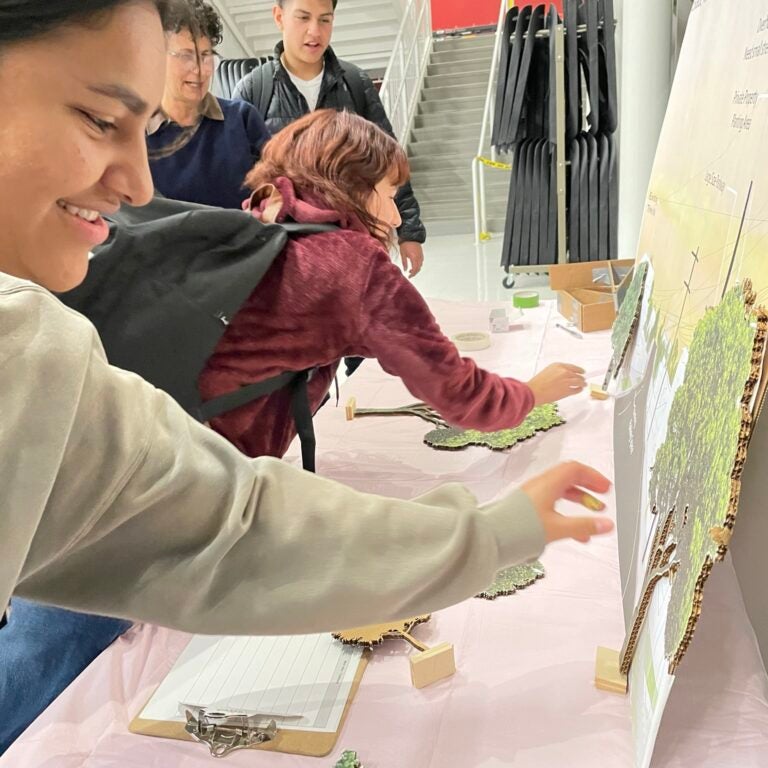
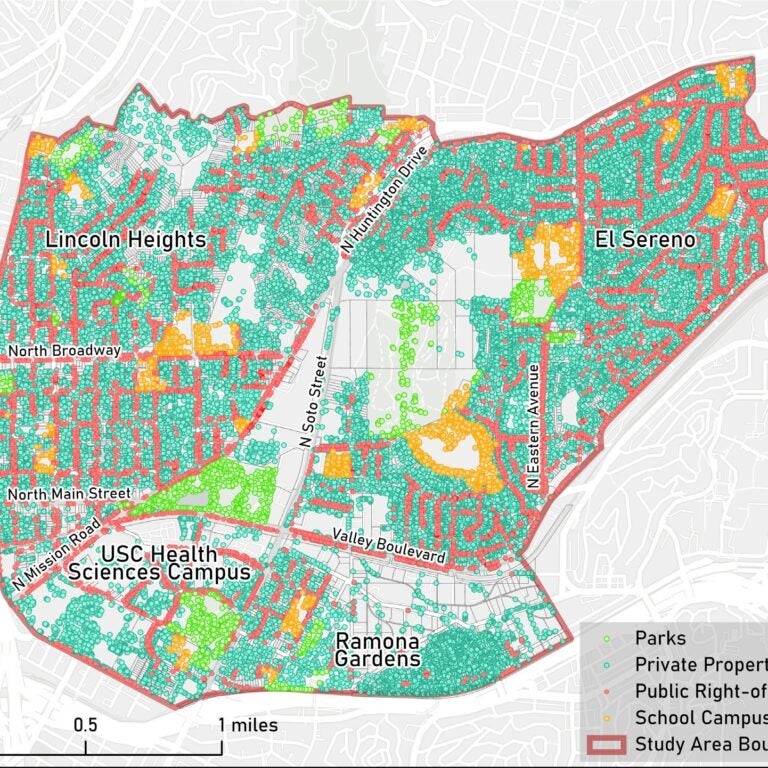
A faculty project director of the USC Urban Trees Initiative, John P. Wilson helped the City of Los Angeles develop a strategic plan to make urban forestry investments in ways to most effectively mitigate urban heat island effects in low-income communities. The work to date has focused on the communities of Lincoln Heights, El Sereno, Ramona Gardens, Boyle Heights, University Park in the City of Los Angeles and City Terrace in Los Angeles County.
With fellow faculty directors William M. Berelson of the USC Dornsife Earth Sciences Department and Esther Margulies of the USC School of Architecture, the USC Dornsife Public Exchange and a constellation of community partners, Wilson and the research team used computer analyses and mapping techniques to describe the existing study area conditions. They examined the natural environment, the built environment and resident demographics. The analysis on study areas residents included elements of race ethnicity, age, income, vehicle access and housing costs relative to their ability to pay.
The research team developed five scenarios identifying the most effective places for planting new trees in areas of greatest need that would create the largest increase in tree canopy. They also identified what kind of trees should be added. Large, dense shade trees that will better tolerate the hotter, drier conditions to come and they found that certain evergreen varieties, such as Cypress and pine trees, actually remove air pollutants.
Beau MacDonald, SSI GIS project administrator, oversaw the SSI student researchers that included Rachel Ablondi, Naman Casas, Eileen Chen, Charles Curtin, Jackson FitzGerald, Erik Huisman, Yuliang Jiang, Carolyn Koh, Jillian Gorman, Joan Lee, Alyssa Ng and Seher Randhawa. The SSI Urban Trees initiative student teams won the 2021, 2022 and 2023 USC Schwarzenegger Institute for State and Global Policy first prize award and the 2022 and 2023 USC Sustainability second prize award.
Wolf-Jacobs, A., Wilson, J.P., Margulies, E., Promoting self-determination, minimizing green gentrification, and maximizing community benefits in urban forestry expansion: A systematic review. Urban Forestry & Urban Greening, 84, 127933 (2023).
We are demonstrating the value proposition and pathways to alternative futures that can improve environmental quality and human well-being in communities with less resources and amenities than others. That’s critical because we need to change how we live to build more sustainable and resilient communities everywhere.
Mitigating air pollution
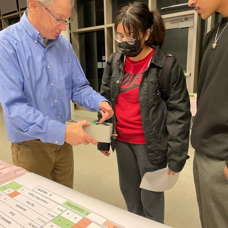
It started with one homemade sensor measuring CO2 and methane levels on the rooftop of his USC lab building. From that humble start, William M. Berelson, professor of earth sciences, environmental studies and spatial sciences, has established a network of sensors through Los Angeles to more accurately assess fine variations in pollutants on a neighborhood scale over time.
By establishing a baseline of current pollutant levels, researchers, policymakers and other decisionmakers can measure the effectiveness of practices, such as driving electric vehicles, riding mass transit or tele-commuting for work.
Berelson’s lab also has been contributing to the USC Urban Trees Initiative by building and deploying new the sensor networks to measure small variations in particulate matter and atmosphere gases (nitrogen oxides and ozone) in and around trees in different locations. That information will help construct a city and county tree species scorecard to improve tree species selection and planting plans by scoring tree species and tree configurations for air quality improvement.
Berelson, W., Rollins, N., Johnson, E., Margulies, E., Casas, N., MacDonald, B., Kim, J., Wilson, J.P., A portable sensor for the determination of tree canopy air quality. Environmental Sciences: Atmospheres, 3, 1186-1194 (2023).
We want a good baseline set of CO2 measurements so we can see how CO2 content in L.A. air is changing over time and, perhaps, due to changes in social behavior.
Planning for a Livable Region
Since 2020, Spatial Sciences Institute student researchers have been contributing to GIS-based projects for SCAG, the Southern California Association of Governments (SCAG). The largest metropolitan planning organization in the nation. SCAG’s jurisdiction includes Imperial, Los Angeles, Orange, Riverside, San Bernardino and Ventura counties.
The centerpiece of SCAG’s planning work is Connect SoCal, its Regional Transportation Plan/Sustainable Communities Strategy.
SSI SCAG interns have provided spatial database management, geoprocessing, data analysis and mapping in support of numerous Connect SoCal projects, including its Regional Housing Needs Assessment (RHNA) and Environmental Justice (EJ) Analysis.
In a recent project, SSI interns processed very high resolution remotely sensed imagery to identify the ground features using object-based image analysis (OBIA). They then utilized ArcGIS Pro to further edit the outputs and assess their accuracy against randomly selected samples.
The Spatial Sciences Institute does a great job in preparing their students to step into professional work. We give them some background and they take off. They have produced sophisticated solutions that we could not have imagined.