
Consider what firefighters and other response teams had to contend with in last summer’s devastating North Complex Fire and the CZU August Lightning Complex Fires in northern California: intense heat, smoke, wind, falling trees and power lines, and the complications of working in socially distant ways due to COVID-19 protocols. These are not exactly ideal conditions in which to fly drones to capture imagery that would inform the spread and impact of the fires.
Moreover, the workflows did not exist to gather the drone imagery and effectively communicate the information to multiple stakeholders, including the public, during the fire crises.
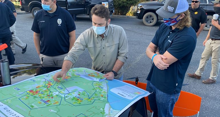
Enter GeoAcuity, a geospatial consulting firm led by Jason T. Knowles, Ph.D., adjunct associate professor of the practice with the USC Spatial Sciences Institute. Knowles and his team at GeoAcuity developed an innovative workflow that utilized ArcGIS Online for drone pilots to get instructions on the flight paths required to capture the imagery that the first-responders needed. Using Site Scan, the team then quickly ingested the captured imagery, publishing it directly to ArcGIS Online. With ArcGIS Dashboards, ArcGIS Web AppBuilder and other Esri products, the team processed and published hundreds of gigabytes of data as completed imagery products within 24 to 48 hours of the drone flight launches for use by law enforcement agencies, emergency response teams, and affected local area residents.
With this new workflow, GeoAcuity was able to support the Butte County Sheriff’s Office in publishing more than three hundred 360-degree individual panoramas in three web maps for the public, as well as supporting the San Mateo and Santa Cruz Counties in publishing 650 individual panoramas shared in two web maps shared with the public.
In the aftermath of the fires, the imagery has helped residents and insurance companies access and process claims, and streamline the response and recovery plans in preparation for future disasters.
Read more about GeoAcuity’s work in Esri’s Winter 2021 issue of ArcNews.

