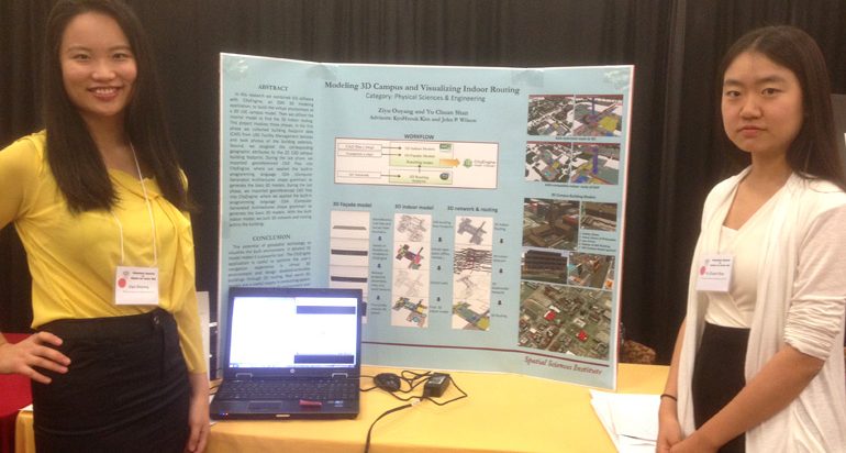

At the USC 17th Annual Undergraduate Symposium for Scholarly and Creative Work on April 15, 2015 in the Ronald Tutor Campus Center, Spatial Science Institute students Ziyu Ouyang and Shan Yu Chuan took second place in the “Digital Media” category for their presentation “Modeling 3D Campus and Visualizing Indoor Routing.”
Ouyang, a GeoDesign major, and Chuan, a Geology major and Spatial Studies minor, presented their research as part of an undergraduate team under the direction of Dr. John P. Wilson and Dr. KyoHyouck Kim of the Spatial Sciences Institute. Their team combined Geographic Information Science (GIS) software with CityEngine, a 3D modeling application by Esri, to build the virtual environment of a 3D model of the USC University Park campus.
In this project, Ouyang and Chuan collected building footprint data from USC Facilities Management Services and photographed building exteriors. They then assigned the corresponding geographic attributes to the 2D CAD campus building footprint. During the last phase, they imported georeferenced CAD files into the CityEngine application, where they applied the built-in programming language CGA (Computer Generated Architectures shape grammar) to generate the basic 3D models. With the built indoor model, they built 3D network and routing within each building.
As a result of this work, Ouyang and Chuan demonstrated the powerful potential of geospatial technology to visualize the built environment in detailed 3D models. They showed the usefulness of the CityEngine application to optimize the user’s navigation experience in virtual 3D environment and to design disabled-accessible buildings through 3D routing.
Ouyang said, “Through this project, I became more familiar with CityEngine and ArcGIS software in the process and its potential for 3D modeling. This symposium was a great opportunity for us to see other undergraduate students’ excellent research projects and to present this 3D campus model project. I want to thank our project director Dr. KyoHyouk Kim and Spatial Sciences Institute for providing such research opportunities for students.”
Shan added, “Participating in the Undergraduate Symposium was a special experience. Our project on the 3D visualization of USC campus using GIS was very different from those involving hard sciences by the other teams. Several judges came to us with great interest and mentioned that they had been talking a lot about our project. It was then I began to realize that GIS is truly an intriguing and exciting new technology. I am therefore more motivated to further explore the great potential of GIS and more applications of spatial sciences in life.”
This annual symposium sponsored by the Office of the Provost provides USC undergraduates with the unique opportunity to exhibit and share examples of their significant research and creativity with the university community. A panel of distinguished faculty judged the submissions. Ouyang and Shan shared a $500 prize.
The Spatial Sciences Institute acknowledges the support of the USC Facilities Management Services for providing the data and Esri for providing the software used in this study.

