
M.S. HSGI Students Publish Article on Their Capstone Project Findings - Applied Geospatial Intelligence Problem Solving
When Elin Henningsson, Elisha Ibanga and Victor Anguiano signed up for their SSCI 595 “Applied Geospatial Intelligence Problem Solving” course as the capstone experience in their USC M.S. in Human Security and Geospatial Intelligence program in the summer of 2019, they quickly discovered that they in fact would be applying their collective skills to address a real-world need. The capstone trio worked on a project for the USC Institute for Creative Technologies (ICT) under the direction of Spatial Sciences Institute faculty members COL [R] Steven D. Fleming, Ph.D., professor of the practice of Spatial Sciences and ICT, and Jason T. Knowles, Ph.D., adjunct associate professor of the practice of Spatial Sciences.
In its role as the university’s Department of Defense-sponsored University Affiliated Research Center (UARC) working in collaboration with the U.S. Army Research Laboratory, ICT is developing the One World Terrain (OWT). This platform is a set of 3D global terrain capabilities and services that replicate the coverage and complexities of the operational environment. The OWT objectives are to support more rapid planning and decision making in human security operations, such as managing a natural disaster area or securing high-value targets in military operations. One aspect of the OWT project is to resolve issues associated with the storing and compiling vast quantities of aerial imagery collected from different sources.
The students’ capstone assignment was to identify the best delivery method for raster mosaics via cloud hosting services through implementation of file compression utilizing the OptimizeRasters Geoprocessing Toolbox and the Mosaic Dataset Configuration Script (MDCS). As the end-user of this data is intended to be an emergency responder operating in a low-bandwidth and austere environments in high-risk situations, the compression method ultimately chosen for ICT’s data needs to be rapidly accessible, facilitating hasty mission planning.
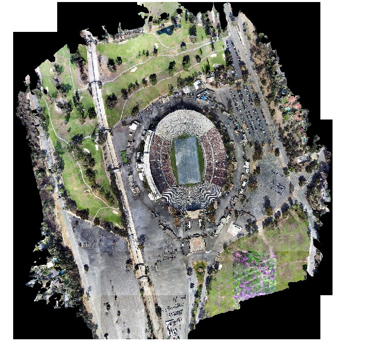
In order to recommend a preferred delivery method, Henningsson, Ibanga and Anguiano worked with and compared two real-world datasets provided by ICT in order to construct raster mosaics. The datasets were orthorectified imagery of USC’s Wrigley Marine Science Center on Catalina Island and the Rose Bowl Stadium in Pasadena, California. Although smaller than the requirements of the planned 3D global terrain, these two data sets allowed the students to test the effectiveness of various compression methods on an example of a large structure in an urban environment, such as the Rose Bowl. and a remote location, such as the Catalina Island science center.
They identified issues with JPEG compression lossiness and the use of ArcGIS Online as an enterprise hosting medium. They determined that MRF_LERC compression is the ideal file configuration also identified ways to improve the MDCS script in order to automate the entire process more efficiently.
Their findings were published on April 10, 2020 in the Journal of Geographic Information Systems in the article “Forward Support—Cloud Based Mosaic Imagery for Emergency Operations.”
In congratulating Henningsson, Ibanga and Anguiano, Fleming said, “Publication in a prestigious peer-reviewed journal is external validation of the high caliber of work of our Human Security and Geospatial Intelligence masters students. The objective of this capstone course is to provide decision makers with informed recommendations regarding a human security setting. The results that Elin, Eli and Victor achieved will directly support geospatial personnel operating in times of crisis to quickly and efficiently download the imagery data they need to their devices and make the decisions that they need to make with this data.”
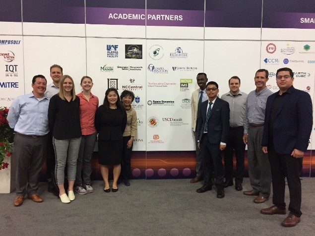
Representing the USC Spatial Sciences Institute at the 2019 USGIF GEOINT Symposium in San Antonio, Texas were (L-R) Ken Watson, Benjamin Friedman, Elin Henningsson, Jill Combs, Mia Poynor, Susan Kamei, Elisha Ibanga, Christian Relleve, Ben Miralia, Steven Fleming and Victor Anguiano
On behalf of the capstone group, Henningson said, “We considered it a career goal to publish our capstone research, and we are excited to have accomplished this. We are very grateful to Professors Fleming and Knowles, as well as the Institute for Creative Technologies, for the incredible opportunity to work on this project and for their ongoing support.”
Ibanga added, “The most rewarding part of publishing our research is the benefit it will provided to other students in this field. Many at the Spatial Sciences Institute and beyond will be able to review our work and build upon it, which means we did our part, however small, in expanding spatial science research.”
“The work of these students will not only benefit the One World Terrain project for warfighters, but also will benefit any organization with the need to compress and store large amounts of imagery data and share that data within their organization, particularly in times of crisis when data needs to be quickly accessible. Organizations such as humanitarian environmental entities face data emergencies during natural and human imposed disasters,” noted Fleming.
As part of their SSCI 595 capstone experience, Henningsson, Ibanga and Anguiano played active roles in the 2019 GEOINT Symposium presented by the United State Geospatial Intelligence Foundation in San Antonio, Texas.
For more information about the USC M.S. in Human Security and Geospatial Intelligence program, visit https://gis.usc.edu/online-programs/masters-human-security-and-geospatial-intelligence/, call (877) 650-9054 or email gis@usc.edu.

