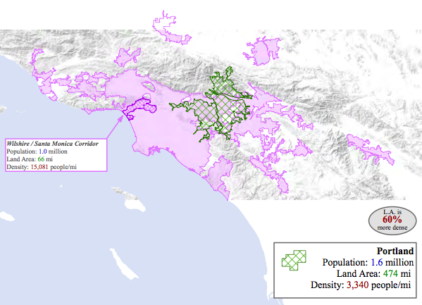
GIST student Samuel Krueger had enough of the claims that Los Angeles was the sprawl capital of the world and lacked an urban core. So he did something about it. Using readily available data, he created maps that compare the Los Angeles metropolitan region to other US urban regions.
He showed that, at 5,337 residents per square mile, Los Angeles is 146% more dense than Boston, 86% more dense than Dallas, 60% more dense than Portland, 44% more dense than Chicago, 25% more dense than New York, 6% more dense than San Francisco.
A native of Portland, Oregon, Krueger developed his analytical skills as a Geography major at USC and has followed up with an MS in Geographic Information Science and Technology as an online student while working in the Water GIS group at the Los Angeles Department of Water and Power. He chose to investigate the unique urban landscape of Los Angeles for his thesis in the 18 month GIST program. His thesis is titled Delimiting the postmodern urban center: an analysis of urban amenity clusters in Los Angeles (August 2012).
As to the allegation that Los Angeles lacked an urban core with the density of street life characteristic of other major cities, Krueger developed a second map. By analyzing data on the location of retail establishments, he mapped their density by street length, creating a proxy measure for street life. The map shows a high density zone that reaches from Downtown in a swath through Hollywood and Mid City to the ocean at Santa Monica.
To download Krueger’s maps and analysis, follow these links:
Urban structure of Los Angeles
The GIST master’s program uses a variety of distance learning strategies to provide an increased knowledge of geospatial technologies and the geographic concepts and methods embedded in them. The courses that make up this program incorporate multiple curricular pathways tailored to the increasingly diverse backgrounds, occupations, and applications that rely on geospatial technologies.


