
The USC Spatial Sciences Institute (SSI) announced the results of a two-year research project to develop the foundation for a uniform, evidence-based understanding of the historical natural habitats of the Los Angeles Basin.
The research team included Philip J. Ethington, Ph.D., Professor of History, Political Science and Spatial Sciences; William F. Deverell, Ph.D., Professor of History and Spatial Sciences; and Beau MacDonald, SSI GIS Specialist. Gary Stein, a doctoral student in the USC Department of History, and Travis Longcore, Ph.D., Associate Adjunct Professor with the UCLA Institute of the Environment and Sustainability, were also part of the research team.
In the first phase of this project, the research team produced:
- the first-ever public-use geo-historical database of map layers, data, historical images, and textual records for the river and watershed area;
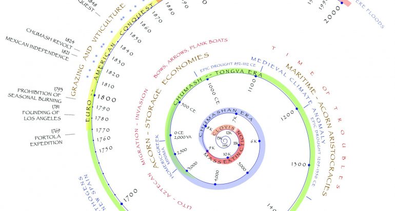
- the first comprehensive chronological framework that specifies the ecological dynamics beginning about 2.5 million years ago and continuing through more than 9.000 years of human civilization;
- an initial assessment at the 1-km scale of the potential natural vegetation of all areas of the Los Angeles Basin; and
- a new assessment of the extent of habitat loss across the Los Angeles Basin due to urbanization over the last two centuries.
Their report, and further updates and data from the project, can be found in digital form at https://lalandscapehistory.org.
This first phase was funded by the John Randolph Haynes and Dora Haynes Foundation. The Haynes Foundation also recently has funded the second phase of the project to expand the multi-institutional collaboration. Included in the expanded collaboration are scholars with California State University, Los Angeles; California State University, Long Beach; and California State University, Northridge.

