
USC SSI teams win NGA Los Angeles hackathon
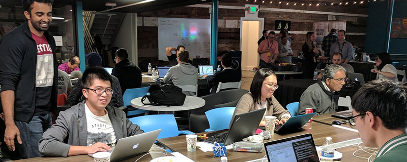 Two teams from the Spatial Sciences Institute of the University of Southern California captured the top prizes at the March 25-26, 2017 hackathon presented by the National Geospatial-Intelligence Agency (NGA) in Los Angeles, California.
The hackathon challenge was how to use geospatial information to better understand, model, visualize, and monitor the nexus between food security and regional stability in Morocco, which is important in predicting and understanding humanitarian/military crises.
The judging criteria for the hackathon were:
- impact for the target audience and its scalability;
- creativity and originality of the solution;
- design from front-end through to user interface and user experience; and
- execution from start to finish.
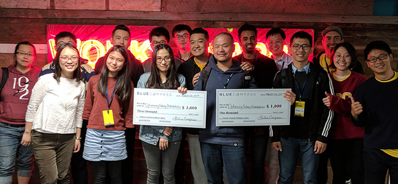
Winning the $3,000 grand prize and the $1,000 crowd-selected award was Team “Optimizing Fishery Distribution to Drought Regions” comprised of USC students Ishan Alok (M.S. Data Informatics), Cheng Gu (M.S., Computer Science), Joanna Wang (B.S. GeoDesign), Zhiyuan Wang (M.S., Computer Science), and Yu Ru (M.S., Data Informatics). The team’s solution created a prediction model for the fishery industry in Morocco to visualize the optimal way to distribute the fish from major fishing ports to inland populated cities. As a leading African country in annual fish production, and a country whose agricultural and livestock yields are highly susceptible to frequent drought, the team argued that fish can be a nutritional and stable food supply for areas with food shortage. Given the limited supply of fish for domestic market, their model estimated the fish catch from 12 major ports and the inland population clusters, and then determined the shortest route between the port and the city using Road Graph plugin in QGIS. Their model allocated the amount of fish to each city based on population, and visualized the delivery route by showing animated dots moving from ports to inland. In 2009, the United Nations initiated Plan Halieutis, aiming to invest in the Moroccan fishing infrastructure and technology. The team believed that this tool, with future refinement, can be an effective and sustainable way to address the food security challenge in Morocco by optimizing fish utility during tranporting.
The first runner-up prize went to Team “Happy Farmer” with members Siyu Deng (M.S., Spatial informatics), Haowen Lin (B.S., Computer Science), Yijun Lin (M.S., Data Informatics), Liwei Xia (M.S., Computer Science), and Steven Yu (M.S., Data Informatics). Each team member received a one-year subscription to Jet Brains software. The Happy Farmer team solution was a web application that gives smart advice on the planting activities for the farmers by predicting next year’s barley production, barley’s consumption, and hunger rate across the county. The app uses linear regression and times analysis to build the prediction models. Based on the hunger rate, the model also indicates arable land that have not been plowed before. The backend cross compares the cultivated land data and land type data to get the area and location of arable lands and recommend them to the consumers sorted by reclamation cost.
Hackathon judges were Rebecca Bridgeford, Municipal Technical Liaison; Charlie Chapin, NGA Tech Scout; Dr. Yao-Yi Chiang, Assistant Professor (Research) of Spatial Sciences, USC Spatial Sciences Institute; Mike Costache, Managing Partner, Krowdmentor; Chris Kalima, Director of Product Development, Planet OS; and Manuela Rayner, NGA imagery Scientist, Food Security SME.
“This hackathon presented our USC spatial sciences, computer science, spatial informatics, and data informatics students with a valuable opportunity to gain exposure to NGA’s work in human security and how they can apply their studies to contribute to a ‘wicked world issue’ such as food security,” said COL [R] Steven D. Fleming, Ph.D., professor of the practice of spatial sciences with the USC Spatial Sciences Institute.
A number of the students on the two winning teams – Ishan Alok, Haowen Lin, Yujin Lin, Joanna Wang, and Zhiyuan Wang – are part of the SSI Spatial Computing Lab. Said Joanna Wang, “As a geospatial data expert in my ‘Optimizing Fishery Distribution’ team, I benefited hugely from my interdisciplinary education in GIS, coding, and political science. This background knowledge allowed me not only to perform solid spatial analysis, but also to provide substantial research on the issue, while communicate efficiently with the ‘hackers,’ who were crucial to carrying out the ideas. My fundamental scripting skill helped me understand how to prepare datasets for programmers to save their time and how to adjust project goal as a trade-off between visions and time constraints. The key to my team’s success in the hackathon was our innovative solution and a compelling tool demonstration.” See the winning team’s reaction in this video.
“We were quite impressed with the solutions presented by the winning USC teams,” said Brian Vinci, Hackathon PgM for Blue Compass LLC. “NGA sponsors these hackathons as a way to develop fresh ideas for government use and engage with creative people on shared government and industry issues, and we find that the innovative solutions are produced by interdisciplinary teams. We look forward to holding another hackathon in the Los Angeles area next year and building upon this year’s network of individuals interested in helping address these geospatial issues.”
The USC Spatial Sciences Institute is designated by the NGA and the United States Geological Survey as a Center for Academic Excellence in Geospatial Sciences. For more information about the Spatial Sciences Institute research and academic initiatives in spatial informatics, spatial computing and digital map processing, spatial analysis and visualization, geospatial intelligence (GEOINT), and geographic information science and technology, please visit spatial.usc.edu or contact Susan Kamei, SSI managing director, at kamei@usc.edu.

