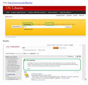

To better share spatial resources with the USC campus community, the SSI GeoPortal is now discoverable through the USC Libraries webpage. Searches for GIS, GIST, spatial, geoportal, geography, geo, SSI, ESRI, GPS, ormap will result in the GeoPortal being shown on the results page. If users first select “Databases” then search for GeoPortal, they will be sent directly to the GeoPortal website.
The USC GeoPortal is a centralized repository of spatial data layers for use by USC faculty, staff, and students. The interface allows users to search, preview, map, and download geospatial data including including contours, land use, parcel data, and select census data for Los Angeles.
Use of the GeoPortal is limited to users on the USC network.

