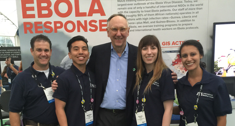

(L-R) Yoav Rappaport (GIS Consultant, International Medical Corps), Matthew Abad (GIS Technician, International Medical Corps), Jack Dangermond (President, Esri), Kacey Pham, and Lydia Nandakumaran (Senior Resource Development Officer, International Medical Corps)
Kacey Johnson Pham – M.S. GIST Alumni Spotlight
I received my Bachelor of Science degree in Geology from the College of Charleston in South Carolina, where I became interested in GIS because the faculty encouraged us to improve our GIS skills. I moved to California because I have family here, and Los Angeles offered a promising GIS job market. I looked around for GIS masters programs and liked what the GIST programs had to offer, mainly because of the flexibility in earning a degree online and the fact that the degree would come from USC.
I’ve had a very positive experience with all of my professors. I was warned that going into an online program at a large school that there would be less one-on-one interaction, but I found that the attention I received from the GIST programs faculty was the same as the amount I’ve gotten doing my undergraduate experience as a resident student.
While I was a GIST graduate student, I was chosen for an internship with the International Medical Corps, a global, nonprofit, humanitarian organization, which I would not have had the opportunity to apply for otherwise. I started out gathering datasets relevant to emergency response around the world, and then within six months I became a full-time employee. They taught me how to set up servers to support complex databases, and at the same time, the classes I was taking at USC went right along with this effort. Through this internship I watched an organization grow a GIS unit, from the ground up. I saw every phase of development of the GIS team as well as the infrastructure. Last month, I was promoted from GIS Analyst to GIS Manager, and I currently lead a team of three GIS professionals as well as interface with senior leadership and other IT professionals. GIS is of great value to my organization because they understand how important spatial context is for making informed decisions in their emergency response efforts and existing humanitarian relief and capacity-building programs in countries in need around the world.
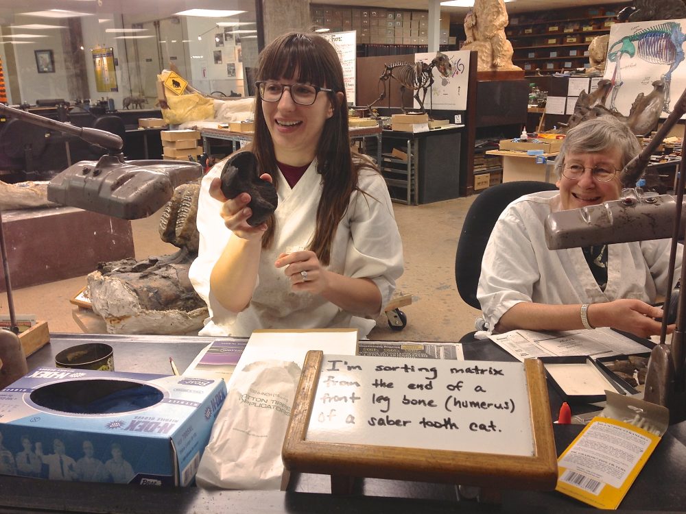
Before interning at International Medical Corps, I volunteered at the La Brea Tar Pits and Museum in Los Angeles. Through that relationship, I began exploring the extensive and amazing La Brea Tar Pits fossil data and began to imagine how it could be spatially analyzed and visualized. I am fortunate to have completed my thesis project with the full support of the paleontologists at the museum. I had the honor of winning the USC Esri Developer Center (EDC) 2016 Student of the Year award as well as the opportunity to present my thesis work at the 2016 Esri Developer Summit in Palm Springs. The best part about my experience at USC is that through the help of GIST professors, I have a great job as a significant contributor to critical humanitarian mapping projects, while also having a paleontological and geological-based thesis project that is completely different! It is the best of both worlds for me – Geoscience and helping to save lives!