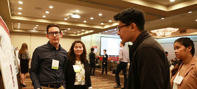
Richard Windisch and Mia Poynor (left) of the USC Spatial Sciences Institute Human Security and Geospatial Intelligence team explain the team’s SmallSat research at the February 22, 2019 Geospatial Summit.
homepage photo: Kevin Mercy on SSI’s HSGI team presented the team’s approach for temporal analysis of 3D data to JPL’s Machine Learning and Instrument Autonomy Group, January 24, 2019.
Ask any faculty member if they would be pleased if they had two articles published in peer-reviewed journals in two months, and undoubtedly they would answer in the affirmative. That Spatial Sciences Institute (SSI) student researchers in the Human Security and Geospatial Intelligence (HSGI) Lab have accomplished this publication feat means they are amassing a publication track record that most faculty members would envy.
SSI M.S. in Geographic Information Science and Technology (GIST) students Richard Windisch and Jong-Su Kim with HSGI co-principal Dr. Andrew Marx have published "Detecting Village Burnings with High-Cadence SmallSats: a case-study in the Rakhine State of Myanmar" in this month’s issue of Remote Sensing Applications: Society and Environment. In this article, the Windisch-Kim-Marx team address the challenge of mass atrocities continuing to occur in areas away from international observers and with poor information outflow, with the international community often learning days or weeks after the onset of violence. While organizations concerned with human rights are increasingly using remote sensing, high-resolution commercial satellites remain an expensive option for monitoring large areas at risk of human rights violations. In order to address the need for rapid alerting of possible human rights violations in remote areas, the team presented an algorithmic approach to leverage affordable, high-cadence, SmallSat satellite imagery to detect the burning of villages in as little as two days of occurrence. This algorithm capitalizes on the constellation’s systematic observations by detecting a potentially destroyed village if its near-infrared reflectance is less than 20% of its control pair for two sequential observations. The algorithm is based on Planet's Dove satellite's near-infrared band, which is a persistent indicator of the destruction of plant cell structure and is less affected by atmospheric scattering than a visible bands.
The team partnered with Planet, a SmallSat company, which through their programming interface provided the team 7,000 images to download and analyze. The team then produced algorithmic estimates of when villages were destroyed; results which were within 82.5% of the ground-reference database provided by their other collaborator, Human Rights Watch. This system demonstrates a functional system to alert human rights practitioners to a potential destruction of villages and to corroborate refugee eyewitness accounts of destruction. This information can also be used to validate refugee asylum claims or as evidence for the prosecution of the perpetrators in international courts.
This SmallSats article comes on the heels of an article by the team published in March 2019 entitled "A Lightweight, Robust Exploitation System for Temporal Stacks of UAS Data: Use Case for Forward-Deployed Military or Emergency Responders" in Drones. Joining Marx on this publication were Windisch and other student researchers Yu-Hsi Chou, an M.S. in Spatial Data Science student, and Kevin Mercy, another M.S. in GIST student.
In this article, the Chou-Mercy-Windisch-Marx team developed a system to do time-series analysis of 3D data – specifically data collected from unmanned aerial systems (UAS). The availability and precision of commercial drones now permit the repeated collection of very-high quality three-dimensional (3D) data to monitor high-interest areas, such as dams, urban areas, or erosion-prone coastlines, but challenges exist in conducting change-detection analysis on the high-quality 3D point cloud. These files are very large in size and contain points in varying locations that do not align between scenes. Because of this, individuals with low computational resources, such as first responders or forward-deployed soldiers, struggle to use this data operationally.
In response, their paper presents an approach that aggregates data spatially into voxels, or 3D spatial cubes of about 1 meter, to provide the user with a computationally lightweight system that still has a robust set of analytic tools for temporal analysis. Their approach offers a solution for organizations analyzing high-resolution, temporal point-clouds with poor computational and connectivity. While this work was developed and supported by The Aerospace Corporation (“Development of Geospatial Techniques and Tools” grant [Award ID: 009264-00004]) for terrestrial analysis. NASA’s Jet Propulsion Lab (JPL) Machine Learning and Instrument Autonomy Group requested a presentation on the approach as they develop the next generation of Martian satellite observatories. Just like first responders, these satellites need a computationally lightweight way to do 3D change detection for meteorite impact detection.
Kim said, “Working on the SmallSats paper was a wonderful experience. Before joining the HSGI research lab, I never would have thought my research could get published in a scientific, peer-reviewed journal – let alone be listed as a co-author. I loved working with my research team and I learned so much from our principal investigator, Dr. Marx. I have a greater appreciation not just for our own work in remote sensing and GIS, but for the process of scientific research writ large. Even though we're just undergrads, it's incredible to see the ideas we brainstormed in the SSI conference room, the workflows we developed over midnight teleconferences, and the maps we made in the Leavey basement, all translated into the glossy, small-font print of a real paper.”
Kim’s teammate Rich Windisch concurred. Windisch added, “I think that I never expected to conclude my research with Dr. Marx’s HSGI Lab at USC with a publication, let alone two publications in two months for two separate research teams. Throughout the process, I was reminded of how grateful I was to come from an interdisciplinary background where yes, the science drives the discovery, but there is also an emphasis of communicating the discovery to others in an accessible manner. The efforts that it took in firsthand organizing the manuscript, assigning roles, copy editing, and communicating with the reviewers were truly collaborative. Our research team did not have an ultimate goal of getting published; we were truly just all very passionate about the research making a positive difference for people on the other side of the world, and a research paper was able to be produced as a result of that. The way I see it, the publication is like a cherry on top of the research experience.”
Mercy also is excited both with the opportunity was very excited with the opportunity to work on this project and with the publication result. He said, "In many of my previous positions, I worked with 3D GIS data, but it was always difficult to effectively analyze the data. Exploitation and visualization of 3D GIS data is a pervading technical issue that will require work from many scientist and developers. With guidance from Dr. Marx, our research team noticed how difficult it was with conventional software to render and analyze large amounts of point cloud data. Therefore, we sought to create a straightforward approach to assist with temporal analysis of point cloud data. I’m very impressed with our progress on the voxelization system, its publication in the Drones journal, and hope that we can continue to develop the system as there are still many 3D GIS issues to be solved!"
Kim, Mercy and Windisch are examples of the outcomes that SSI students can have who start their research activity with SSI faculty researchers as undergraduates and then continue on SSI research projects while in an SSI masters program. Kim is obtaining his B.A. in International Relations and SSl’s online M.S. in Geographic Information Science and Technology (GIST) program on a progressive degree path, enabling him to complete his M.S. in GIST degree concurrently with his undergraduate degree in a total of five years. A B.A. in Interdisciplinary Archaeology major with minors in Geospatial Intelligence and Computer Programming, Mercy likewise is concurrently progressing towards an SSI M.S. in GIST. A B.S. in GeoDesign major, Windisch also is progressing towards an SSI M.S. in GIST degree.
From Windisch’s perspective, the experience he, Kim and Mercy have had to participate in SSI faculty-directed research as both undergraduate and masters students paves the way for more students to follow a similar trajectory in working on publication-worthy projects. Windisch shared, “When I heard that our research was going to be published on a peer reviewed scientific journal, it was a strong validation of our hard work, and it was quite a joy to see that the efforts we took to undertake a study were fruitful. This publication serves as an inspiration to do more and more quality work. Personally, it was a huge relief to get that email saying, ‘Your article has been accepted’ and brought me a sense of calmness and confidence to pursue more projects, including the thesis for my M.S. in GIST degree.”
“It’s a joy to work with these talented and dedicated students,” said Marx. He added, “We are using our SmallSats work to collaborate with Human Rights Watch and Physicians for Human Rights to help prevent genocide, and we will be presenting our UAS work at the upcoming U.S. Geospatial Intelligence Foundation’s annual 2019 GEOINT Symposium in June in San Antonio, Texas.”
Read a recent story about the work of the Spatial Sciences Institute Human Security and Geospatial Intelligence Lab to prevent genocide and learn more about the HSGI Lab here.

