Geodesign alumni highlights
Meet some Geodesign graduates who are transforming our world.

Alex Chen, B.S. Geodesign ’18; Columbia University, Master of Public Health ’20
The Geodesign curriculum along with a public health minor at USC gave me a unique framework to look at health disparities that manifested through place, a critical variable that has historically been overlooked in the analytical phases of public health research. I am particularly interested in mitigating health disparities through community-based work and policy.
With a technical background in social epidemiology, data science, urban studies, and geographic information science (GIS), today I am a data analyst with extensive experience using government, survey and clinical datasets to understand issues and trends in population health. I’m currently working on Health Dashboard Projects in the Division of Epidemiology, Department of Population Health, at NYU Langone Health.

Grace Corsi, B.S. Geodesign and B.A. Jazz Voice ’19
Whether it was constructing elaborate forts as a child, singing in choirs, composing music, or designing treehouses, I’ve always found immense joy in the process of creating. This carried into my studies at USC, where I double-majored in Jazz Voice and Geodesign.
I chose Geodesign because of its solution oriented approach to cities and sustainability. The major emphasizes a value-based, creative design process grounded in geographic information. In a world increasingly driven by economic profit, I think this idealistic yet data-driven approach is vital in addressing environmental and social issues. With classes in architecture, design, geographic information and public policy, the major has expanded my thinking in the process of creative problem-solving.
Today I am the West Planning Leader for DLR Group, an integrated design firm delivering architecture, engineering, interiors, planning and building optimization for new construction, renovation and adaptive reuse. My planning approach combines data analysis with the lived experience of communities to arrive at more equitable, sustainable and resilient decisions. In this role, I can be a passionate advocate for centering equity and community health in planning processes.

Harrison Knapp, B.S. Geodesign and B.A. Earth Sciences ’20; M.S. Spatial Data Science ’22
Courses in spatial design and thinking led to others in GIS programming and customization in Python, data analysis for the earth sciences and advanced cartography. I ventured outside the classroom into research and internships that allowed me to work with all kinds of geospatial datasets: satellite imagery and oceanographic data at the NASA Jet Propulsion Lab, composite snow data products and climate indices at the NOAA Pacific Marine Environmental Lab, and light pollution metrics from both remote and in situ sensors at the USC Spatial Sciences Institute.
With an understanding of the nuances of data architecture, the power of machine learning, and experience working with geospatial big data, today I am a remote sensing scientist with The Aerospace Corporation, and I remain motivated to continue developing as a data scientist.

Samantha Levi, B.S. Geodesign ’20; M.S. Geographic Information Science and Cartography, Technische Universität Dresden | Technische Universität München | Technische Universität Wienhe
I am so grateful for my time as a Geodesign student and all of the personal connections and professional opportunities it gave to me. While at the Spatial Sciences Institute, I met an array of amazing people who not only became great friends but also an invaluable part of my professional network.
Beyond the classroom, the program helped open up so many doors for me, allowing me to conduct research on Catalina Island, present at conferences like the Los Angeles Geospatial Summit and intern at Esri.
The Geodesign program helped me realize my passion for spatial science and cartography, which led me to pursue an international Masters in Cartography from the Technical Universities of Munich, Vienna and Dresden.
Since graduation, I have continued to conduct research in the spatial sciences and currently work as a cartographer in Dresden, Germany.
Learning objectives
General Skills and Breadth
- Develop the ability to manage one’s time, work independently, take initiative, and collaborate.
- Develop the ability to think critically, analyze, synthesize, and use information to solve problems.
- Acquire broad knowledge in the humanities, social sciences, mathematics, and physical sciences, and understand the relevance of these disciplines to Geodesign at the intersection of the spatial sciences, architecture, and urban planning.
- Develop the ability to communicate ideas and articulate positions orally and in writing.
- Develop facility in the use of computer applications and the Internet.
Scientific and Design Skills
- Develop an understanding of the myriad ways in which places can be constructed, interpreted, and experienced by different people (i.e., migrants, people of color, the elderly, the poor, teenagers, toddlers, working adults, and more).
- Learn about the principles of design and how these can be used as a force for good in building healthy, livable and sustainable communities.
- Learn how urban and regional planning provides a framework for promoting civic engagement and collective action.
- Develop an understanding of how geographically referenced data can be gathered and organized to support a large number and variety of collaborative projects.
- Learn how geospatial data can be analyzed, modeled and visualized to inform design and planning and by doing so, support public participation and urban development.
- Learn how form and function co-exist and evolve in urban settings and how globalization connects near and far-away places and actions.
Ethics/Society
Be able to place spatial and geographic knowledge into an ethical context, especially how spatial sciences and geodesign principles can contribute to the resolution of ethical, social, and environmental issues.
After Graduation
Develop a sufficient depth of knowledge and abilities in preparation for entry-level employment in a wide variety of fields, or for graduate study in the spatial sciences or other related disciplines.
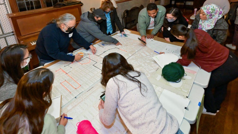
Communicating impact with StoryMaps
SSI students use GIS-based maps with interactive narratives to share their research
An Overview of the USC GeoHealth Hub | Amanda Rago and Violet Li
SSI students created the USC GeoHealth Hub to support the health-care systems in the Southern California region by gathering and providing publicly accessible health datasets and resources in an easily accessible and usable platform. Working with the Southern California Environment Health Sciences Center and the USC Norris Cancer Center, the student team curated and uploaded spatial data sets in categories such as disease, addiction, pollution and mental health, and developed the hub site to further engagement between funding agencies, decision-makers and communities.

Finding Climate Refuge: A Preliminary Analysis of the Joshua Tree Forest in California, USA | Elisa Barrios
This StoryMap presents a GIS model that details the threats of climate change on the Joshua tree forest in California, providing an overview of suitability analysis, explaining the unfortunate influence that climate change will have on the forest and calling to action adoption of adaptation strategies.

EV in LA: Charging Infrastructure & Accessibility | Baoqi Eileen Chen
This StoryMap started out as a project in SSCI 402: Geospatial Technology Management for Sustainability Science. Eileen wanted to describe the supplies and demands of EV infrastructure as a basis for informing sustainable urban planning and development. She developed a framework that identified potential policy advisories for building out supplemental infrastructure and provides analysis of sustainability initiatives such as zero-emission zone pilot projects.
CURRICULUM
PRE-MAJOR COURSES
-
Behavior of firms and consumers, functions of the price system, competition and monopoly, labor markets, poverty, government regulation, international trade, and the environment. Syllabus.
-
An introduction to the basic tools of statistics. Descriptive statistics; probability; expected value; normal approximation sampling; chance models; tests of significance.
CORE COURSES
-
Conceptual foundations and techniques of statistics and how they can be used with geographic data to produce actionable information across spatial science domains.
-
Foundations of geodesign combining place-making, design, collective action, and the science of location-based information to improve human interaction with the functioning of the Earth.
ARCHITECTURE SEQUENCE
-
Methods for direct observation and recording of the directly experienced built environment through drawing, diagramming, photographing, and writing. The course includes exercises and field experience.
-
Introduction to design principles and processes; sequence of exercises emphasizing the development of basic skills, ideas, and techniques used in the creation of simplified urban space design projects. Prerequisite: ARCH 203.
-
Emphasis on developing advanced urban spatial design solutions set within contemporary urban conditions, with a particular emphasis on ecology, public space, neighborhoods and districts. Prerequisite: ARCH 303.
PLANNING SEQUENCE
-
Gateway to B.S., Public Policy, Management and Planning and minor in Planning and Development. City building and development process; who plans; politics of planning and development; major topics include land use, fiscal policy, transportation, sustainability, and economic development.
-
Historical evolution of planning and development. How changing modes of planning and development have shaped the built landscape throughout the century.
-
Theories and concepts of livable communities and good city form; case studies of historical and current best practices; field visits; collaborative design project.
SPATIAL SCIENCES SEQUENCE
-
Role of maps and spatial reasoning in the production and use of geographic information for representing and analyzing human and environmental activities and events.
-
The various ways in which geography can be used to acquire, represent, organize, analyze, model and visualize information. Laboratories are organized around ArcGIS software suite. Prerequisite: SSCI 301L.
-
Fundamentals of spatial modeling and remote sensing and how to use GIS customization and programming to streamline complex spatial analysis and modeling workflows. Syllabus. Prerequisites: SSCI 301 and SSCI 382.
MAJOR ELECTIVES
The major electives provide students with opportunities to explore one or more facets of the built environment and a series of complementary analytical and visualization tools in more detail. A suite of courses that further the development of practical, theoretical, and field knowledge and skills, including computer graphics, drawing, policy analysis, public finance, and statistics. Choose additional electives from the two lists equal to six courses (24 units) in all. No more than two courses may be lower division (100 or 200 level). At least two courses must come from Group A and two courses from Group B.
-
ARCH 306m: Shelter (4 units)
Investigation of issues, processes, and roles of individuals, groups and communities in relation to present and future shelter needs and aspirations.
ARCH 447: Ecological Factors in Design (3 units)
Lectures, laboratory exercises and field trips introduce basic knowledge of incorporating ecological factors in urban design and interaction of landscape science with the human environment.
ARCH 447: Ecological Factors in Design (3 units)
Lectures, laboratory exercises and field trips introduce basic knowledge of incorporating ecological factors in urban design and interaction of landscape science with the human environment.ENST 323: Politics of Global Environment (4 units)
Examines the politics of managing the global environment. The nature of ecosystems, commons problems, population and resource utilization problems along with biodiversity and global governance are emphasized.ENST 345: Conservation of Natural Resources (4 units)
Interaction between resource conservation and people based on recent advances, current developments, and future resource utilization. Special attention to the western United States. Field trips.HIST 458: History of California (4 units)
Exploration, colonization, and development of Hispanic California; coming of the Americans; political, economic, and cultural development of California since its acquisition by the United States.POSC 363: Cities and Regions in World Politics (4 units)
Cities and the rise of states; globalization and localization; federalism and decentralization; comparative politics of urban regions in developed and developing countries.PPD 360: Urban Transportation Planning and Policy (4 units)
Current transportation planning and policy critiques. Transportation planning: the relationship to urban structure; conventional and para-transit modes; analysis of local plans.PPD 361: Sustainable Communities, Policy and Planning (4 units)
Policy and planning as shaped by sustainability indicators; topics include water resources, air quality, land use regulations, environmental design, carrying capacity, ecological footprint analysis. Syllabus.PPD 410: Comparative Urban Development (4 units)
Urbanization and urban development and growth through an international scope; globalizing cities.SOCI 335: Society and Population (4 units)
World population trends and their consequences: determinants of fertility, mortality, and migration; development of elementary models of population change.SSCI 165Lgw: Sustainability Science in the City (4 units)
The influence of sustainability science on public policy and vice versa in the context of social/ethical theories, analytical methods and solutions. Syllabus.SSCI 214g: Human Populations and Natural Hazards (4 units)
Introduction to the complex relationship between human development and natural hazards, which are increasingly causing damage and displacement to human populations throughout the world. Syllabus.SSCI 265Lg: The Water Planet (4 units)
An exploration of earth’s water, ranging from water properties, chemistry, and pollution, to groundwater dynamics, watershed processes, and oceanic-atmospheric circulation. Implications for past and future societies. Lecture and laboratory. Syllabus.SSCI 350: International GeoDesign (4 units)
Intensive living-learning research and field experience in Los Angeles and abroad; application of GeoDesign strategies to local societal challenges. Syllabus. -
ANTH 481L: GIS for Investigating the Past (4 units)
Training of archaeology students in the use of GIS through the understanding of basic principles and theoretical restrictions of geospatial sciences.
ARCH 307: Digital Tools for Architecture (3 units)
Exploration of digital tools with an emphasis on building information modeling (BIM), parametric modeling, and interoperability including special topics in Architecture/Engineering/Construction (AEC) and sustainable design.Recommended preparation: basic computer skills.
DES 102: Design Fundamentals (4 units)
Introduction to the basic elements and processes of visual communication and design. Instruction includes studio projects, lectures and readings. Various media used. Duplicates credit in the former FA 102.ENST 387: Economics for Natural Resources and the Environment (4 units)
An introduction to the economic tools and issues that affect natural resource use and environmental management.HIST 393g: Quantitative Historical Analysis (4 units)
Reading and doing quantitative research with historical data. Covers research designs, appropriate statistical analysis, and software packages for the use of historians.IR 323: Politics of Global Environment (4 units)
Examines the politics of managing the global environment. The nature of ecosystems, common problems, population and resource utilization problems along with biodiversity and global governance are emphasized.POSC 265gw: Environmental Challenges (4 units)
Examination of the challenges of environmental problem-solving at the personal, local, national and global scales, focused on the issue of climate change.POSC 363: Cities and Regions in World Politics (4 units)
Cities and the rise of states; globalization and localization; federalism and decentralization; comparative politics of urban regions in developed and developing countries.POSC 436: Environmental Politics (4 units)
The political realities of selected environmental issues; resolving and implementing social priorities; interests, attitudes, strategies, and tactics of pressure groups; institutional biases and opportunities.PPD 306: Visual Methods in Policy, Management, Planning and Development (4 units)
Introduction to graphic design, photo documentation, and geographic information systems as employed in planning, policy, and development. Visual explanations. Computer and by-hand applications. (Duplicates credit in former PLDV 410.)PPD 427L: Geographic Information Systems and Planning Applications (4 units)
Basic GIS concepts, ArcView and other GIS software, planning applications and databases, basic cartography; students select, research and prepare a planning GIS analysis project.SOCI 365: Visual Sociology of the Urban City and Its Residents (4 units)
Integration of the production of visual representation into the disciplined study of social relations by using the camera as data gathering technology. Syllabus.SSCI 135Lg: Maps in the Digital World (4 units)
The role of formal reasoning, abstract representation and empirical analysis in building maps for sharing knowledge across the physical, life and social sciences and humanities. Syllabus.
CAPSTONE COURSE
-
Application of design concepts, planning protocols and spatial analysis skills to a complex planning or design problem sponsored by a local public, private or not-for-profit client in a studio setting.
Learn more
-
Talk with Dr. Diana Ter-Ghazaryan, Director of Undergraduate Studies, Spatial Sciences Institute about the advantages of being a Geodesign major or adding Geodesign as a double-major. E-mail her or call her at (213) 821-1190.
-
Candidates for the B.S. in Geodesign can qualify for graduation with departmental honors:
Eligibility requirements
Geodesign majors with cumulative GPA ≥ 3.7 in department courses in their second to last semester and an overall GPA ≥ 3.5.
In addition, to qualify for the honors designation, Geodesign majors must complete one or both of the criteria listed below:
- Students present a poster or make a presentation of their research at a venue such as the Provost’s Undergraduate Research Symposium, the Los Angeles Geospatial Summit, or another professional conference; and/or
- Students exhibit leadership within a club or organization (e.g., SC Mappers), serve as a speaker for an academic event (e.g., GeoDesign Speaker Series), or represent the B.S. in Geodesign program in some effective way.
Enrollment Process
Eligible and eligible students apply for the Geodesign Honors Program and are enrolled in the Geodesign Honors Program by their academic advisor preceding their final semester.
Honors Application
Students are required to submit to the Geodesign academic advisor an application package that includes the following items: name, student ID, major, GPA (overall and in the department), current and dated resume, STARS report, and proof of participation for distinction of honors. Geodesign majors meeting the GPA and other criteria in their final semester also will be invited to apply in their final semester at the discretion of the Geodesign Honors Program evaluation committee.
Evaluation and Designation of Honors Distinction
A Geodesign Honors Program evaluation committee–comprised of at least one faculty representative from the School of Architecture, Price School of Public Policy, and the Spatial Sciences Institute–will be formed each year by the Spatial Sciences Institute Director of Undergraduate Studies to identify and assess which Geodesign majors will receive the honors designation.
Honors Designation:
There is not a fixed number of honors designations that can be awarded each year.
B.S. in Geodesign students who earn the honors designation will see the designation on their USC transcripts. This honors designation is not printed on diplomas.
-
The USC Progressive Degree Program enables superior USC undergraduates to begin work on a master’s degree while completing requirements for their bachelor’s degree. Students who are admitted to a master’s program with a progressive degree option can complete both their bachelor’s and master’s degrees in five years.
With a progressive degree path, B.S. in Geodesign could lead to a:
- M.A. in Environmental Studies
- Master of Planning
- M.S. in Geographic Information Science and Technology
- M.S. in Spatial Data Science
- M.S. in Spatial Economics and Data Analysis
- M.A. in Global Security Studies
A B.S. in Policy, Planning, and Development or a B.S. in Architectural Studies could lead to a:
- M.S. in Geographic Information Science and Technology.
Consult the USC Progressive Degree Program information and discuss specific details about your interests and goals with Monica Pan, SSI academic advisor, at monicap@usc.edu.


