Team Archaeology and GIS: Innovations in the Field
12:00 – 12:45 p.m.
Spatial Sciences Institute Conference Room (AHF B57J)
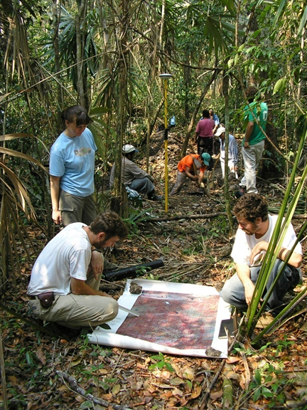
How do you find Maya tombs and temples underneath dense Central American jungle vegetation? Thomas Garrison, Assistant Professor (Teaching) of Anthropology, explains how he uses remote sensing to examine the earth surfaces for evidence of human habitation in his archaeological research in Guatemala. Darren Ruddell, Assistant Professor (Teaching) of Spatial Sciences and Director, Undergraduate Studies, USC Dornsife Spatial Sciences Institute, joins him for this discussion of how archaeology and GIS are working together to
discover, document, and reconstruct Maya life.
Dig!
1:00 – 1:30 p.m.
USC Associates Park (along Childs Way)
Join Archaeology, GeoDesign, and Spatial Studies students as they demonstrate field applications of geospatial science and technology in archaeological excavations. Learn how remote sensing, aerial imagery, and GPS systems are helping archaeologists in Guatemala uncover
ruins of ancient civilizations.
Date/Time
November 19, 2014 @ 12:00 pm - 1:30 pm

