Mapping Nearshore and Riverine Environments with Topobathymetric LiDAR
Andrés Vargas, NV5 Geospatial
Participate by Zoom
or join us for the livestream in the SSI Conference Room
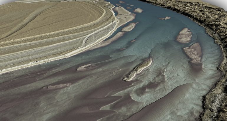
Topobathymetric LiDAR utilizes a green wavelength laser to penetrate the water surface and make measurements of the submerged land below. This technology combines with traditional near infrared LiDAR to map the entire landscape above and below the water. Its many important applications include shoreline and coastal resiliency, habitat restoration and mapping, floodplain modeling, and volumetric analysis.
While this technology shares a lot with the traditional airborne LiDAR mapping, there are also significant differences and major challenges. Special considerations need to be paid to acquisition conditions and planning to not only ensure the best remote sensing practices are followed, but also optimize bathymetric performance. Utilizing the green wavelength to map below the surface of the water introduces specialized workflows in both acquisition and data processing to account for correct coverage and refraction of the submerged points.
 Hear Andrés Vargas, an expert in airborne remote sensing and LiDAR sensor technology, about how this specialized capability can greatly increase your knowledge critical to managing riverine and coastal environments.
Andrés is responsible for sensor integration, testing, and calibration and oversees the topobathymetric data processing workflow. Additionally, he has been instrumental in developing NV5 Geospatial’s topobathymetric LiDAR acquisition and calibration methods.
Date/Time
November 15, 2022 @ 12:30 pm - 1:30 pm
Location
Spatial Sciences Institute Conference Room (AHF B57)

