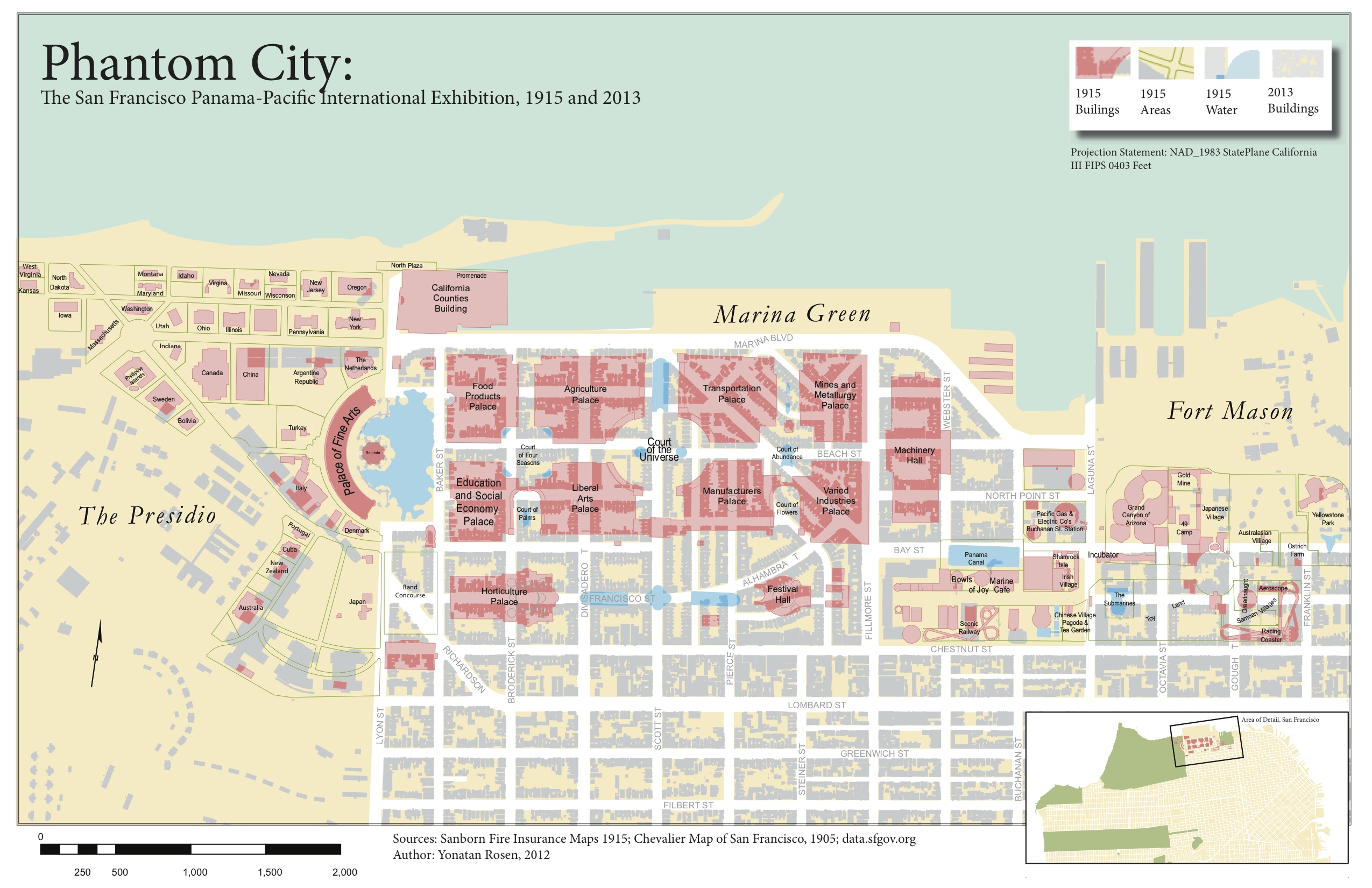
Six USC GIST students have had their maps selected for display at the 2014 Esri User Conference Map Gallery this July in San Diego. Professor Kirk Oda recruited students from his course, SSCI 589 Cartography and Visualization, to compete to display their maps at Esri's flagship professional meeting. The top six submittals from the class will be shared at the Map Gallery and the students will answer questions about them at the opening reception for the event.
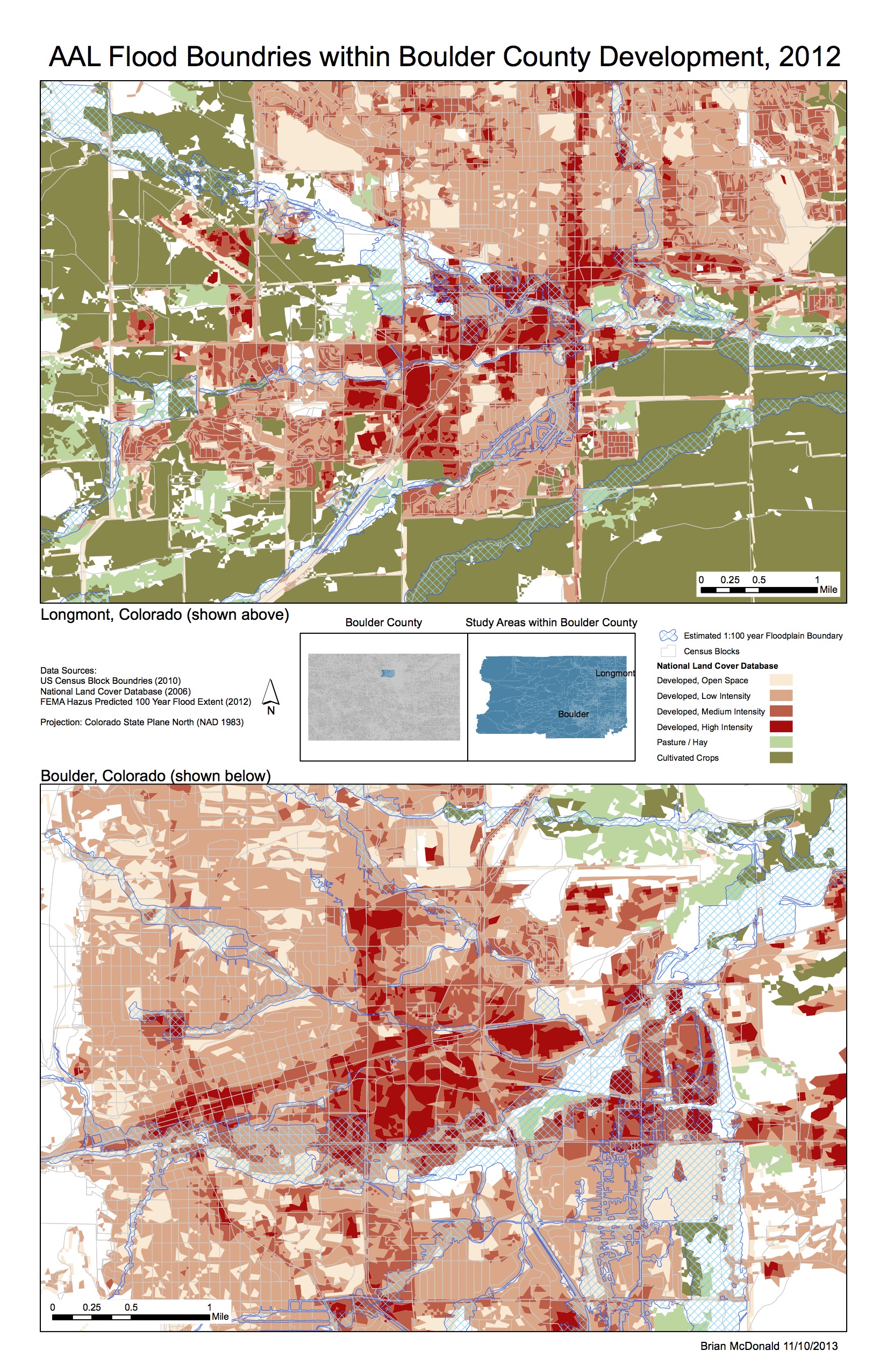
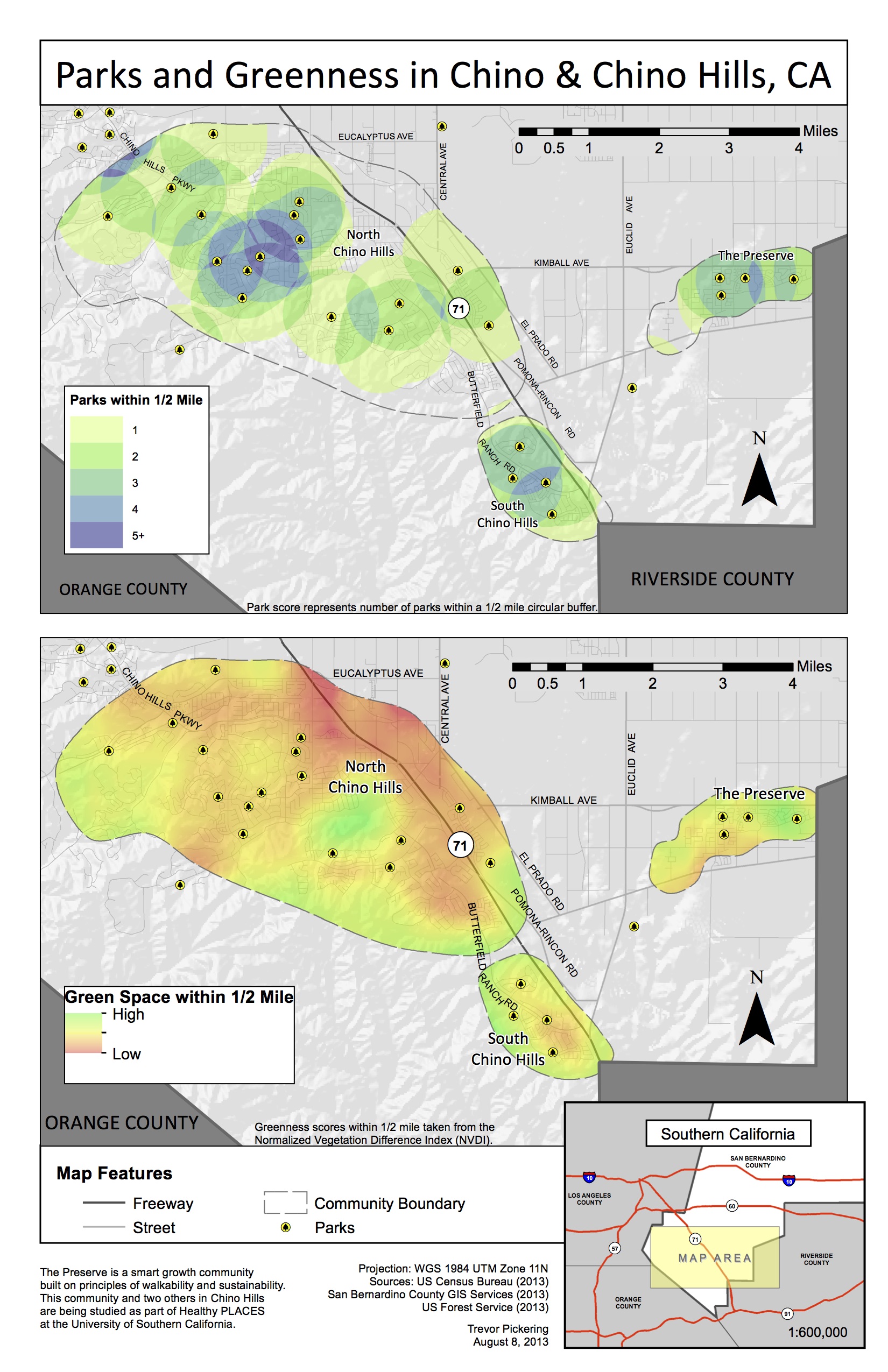
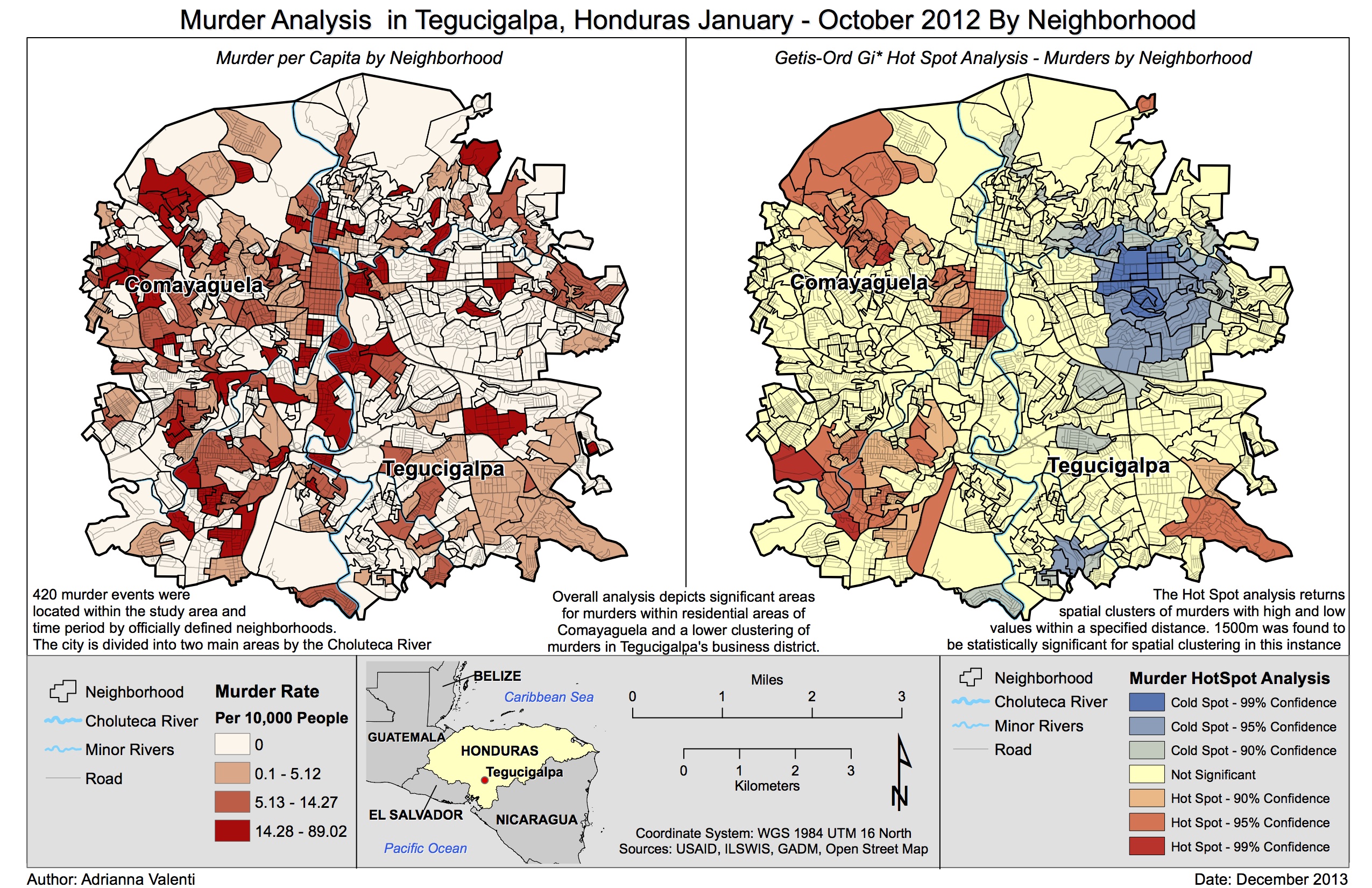
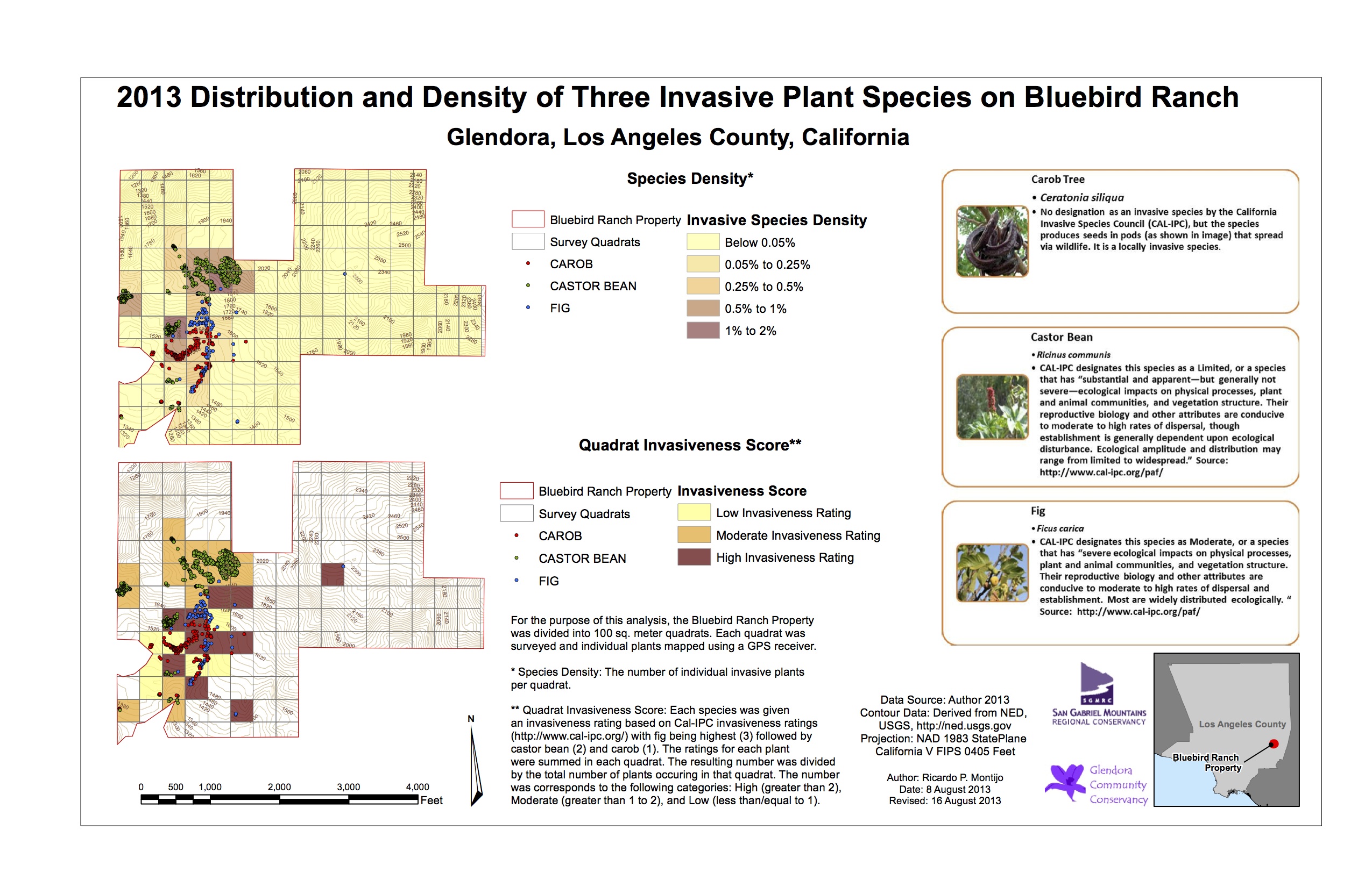
The maps represent a range of approaches and analyses to data across the hemisphere, ranging from flood boundaries in Colorado to invasive species mapping in Los Angeles to murder rates in Honduras. Click on the gallery below to see high-resolution versions of the maps.