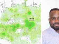
Identifying “hot streets” to reduce crime MS GIST Alumnus Quincy Tom-Jack publishes thesis work in the International Journal of Geo-Information Law enforcement agencies have long used geographic information systems (GIS) to determine spatio-temporal crime patterns and have used spatial analysis to identify crime “hot spots” -- spatial clusters of high crime areas. However, existing analytical…
Read more
Identifying “hot streets” to reduce crime


