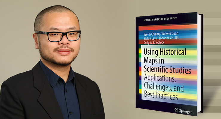
SSI’s Yao-Yi Chiang leads publication of new book
 Since the early 1980s, the computer science and geographic information science (GIS) communities have intersected in their interest in digital map processing. Through the technological advances in digital map processing, researchers across multiple scientific domains have come to realize the great potential of accessing information that has been “locked” in historical maps in their pre-digitized state. However, existing researchers have struggled to understand how to use the information in historical maps in their work, how to efficiently and effectively digitize their maps, and how to apply the best practices in digital map processing.
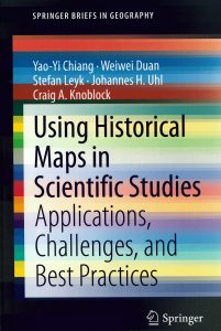
The recently published book Using Historical Maps in Scientific Studies: Applications, Challenges, and Best Practices provides scientists, researchers, librarians, and other users of long-term historical geographic data with this much-needed guide. Dr. Yao-Yi Chiang, associate professor (research) of spatial sciences at the University of Southern California (USC) Spatial Sciences Institute, led the author team of Weiwei Duan, Ph.D. student in computer science at USC; Dr. Stefan Leyk, associate professor at the Department of Geography, University of Colorado, Boulder; Dr. Johannes H. Uhl, postdoctoral research associate, University of Colorado, Boulder; and Dr. Craig A. Knoblock, research professor of computer science and spatial sciences at USC.
The book includes case studies introducing typical types of semi-automatic and automatic digital map processing technologies and showcase the strengths and weaknesses of semi-automatic and automatic approaches by testing them in a symbol recognition task on the same scanned map. One chapter is devoted to presenting the technical challenges and trends in building a map processing, modeling, linking, and publishing framework. Another chapter dives into the recent advancement in deep learning technologies and their applications on digital map processing and reviews existing deep learning models for their capabilities on geographic feature extraction from historical maps and compares different types of training strategies.
“The full potential of historical maps has not been realized because the users of scanned historical maps and the developers of digital map processing technologies are from a wide range of disciplines and often work in silos,” said Chiang. “Our book is intended to help readers transcend those disciplinary silos and take advantage of these technologies to use the data in historical maps more powerfully.”
Chiang is the director of the SSI Spatial Computing and Informatics Laboratory and the associate director of the NSF’s Integrated Media Systems Center (IMSC) at USC. Knoblock is the executive director of the USC’s Information Sciences Institute (ISI), research director of the Center on Knowledge Graphs, and associate director of USC’s Informatics Program.

