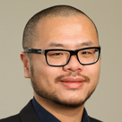
Dr. Yao-Yi Chiang, assistant professor (research) of spatial sciences with the USC Spatial Sciences Institute, delivered a keynote address at the Second International Workshop on Exploring Old Maps (EOM 2017) at the University of Wuerzburg, Germany, on April 6, 2017.
In his address "Querying Historical Maps as a Unified, Structured, and Linked Spatiotemporal Source," Dr. Chiang discussed how historical spatiotemporal datasets are important for studies in areas such as cancer and environmental epidemiology, urbanization, and landscape ecology. Existing data sources typically contain only contemporary datasets, yet historical maps hold a great deal of detailed geographic information at various times in the past. However, finding relevant maps is difficult and the map content are not machine readable.
Chiang shared his map processing, modeling, linking, and publishing framework that allows querying historical map collections as a unified and structured spatiotemporal source in which individual geographic phenomena (extracted from maps) are modeled with semantic descriptions and linked to other data sources (e.g., DBpedia). This framework will make it possible to efficiently study historical spatiotemporal datasets on a large scale. Realizing such a framework poses significant research challenges in multiple fields in computer science including digital map processing, data integration, and the Semantic Web technologies, and other disciplines such as spatial, earth, social, and health sciences.
Chiang's map processing approach not only advances research in computer science, but also represents novel approaches in interdisciplinary research.


