NSF consortium program supports pandemic research and education
The Geospatial Software Institute (GSI) Conceptualization Project has announced that it has awarded fellowships to Dr. John P. Wilson and Dr. Kenan Li of the Spatial Sciences Institute at the University of Southern California to tackle COVID-19 challenges using geospatial software and advanced capabilities in cyberinfrastructure and data science.


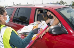
Wilson is a professor and SSI founding director and Li is a research scientist with SSI. In partnership with the Los Angeles County Emergency Food Security Branch, Wilson and his research team recently contributed to a USC Dornsife Public Exchange study on the impact of COVID-19 on food security in Los Angeles County.
The GSI Conceptualization Project is supported by the National Science Foundation (NSF). Its partners are the American Association of Geographers (AAG), Consortium of Universities for the Advancement of Hydrologic Science, Inc. (CUAHSI), the National Opinion Research Center (NORC) at the University of Chicago, Open Geospatial Consortium (OGC), and University Consortium for Geographic Information Science (UCGIS). Technical and cyberinfrastructure support are provided by the CyberGIS Center for Advanced Digital and Spatial Studies (CyberGIS Center) at the University of Illinois at Urbana-Champaign.
“The COVID-19 crisis has shown how critical it is to have cutting-edge geospatial software and cyberinfrastructure to tackle the pandemic’s many challenges,” said Shaowen Wang, the principal investigator of the NSF project and founding director of the CyberGIS Center. “We are extremely grateful for NSF’s support to fund this talented group of researchers, whose work is so diverse yet complementary.”
Michael Goodchild, chair of the NSF project advisory committee and professor emeritus in geography at the University of California, Santa Barbara, agreed. “Geospatial data and tools have enormous potential for helping us address the challenges of COVID-19, and these 16 Fellows have exactly the right qualifications and experience. I'm very excited to see what they are able to achieve.”
Wilson and Li are two of 16 fellows at 13 institutions with varied professional, cultural and institutional backgrounds. The fellows work in many disciplinary areas, including public health, food access, emergency management, housing and neighborhood change, and community-based mapping. The fellowship projects represent frontiers of emerging geospatial data science, including for example geospatial AI and deep learning, geovisualization, and advanced approaches to gathering and analyzing geospatial data. A full list of the fellows, with biographies and project information, is at https://gsi.cigi.illinois.edu/geospatial-fellows-members/.
CyberGIS – cyber geographic information science and systems based on advanced computing and cyberinfrastructure – has emerged as a new generation of geographic information science (GIS). Pioneered by multi-million dollar research funded by NSF, cyberGIS seamlessly integrates advanced cyberinfrastructure, GIS, and spatial analysis and modeling capabilities to support widespread research advances and broad societal impacts.
Built on the progress made by cyberGIS-related communities, the GSI Conceptualization Project is charged with developing a strategic plan for a long-term hub of excellence in geospatial software infrastructure, one that can better address emergent issues of food security, ecology, emergency management, environmental research and stewardship, national security, public health and more.
The Geospatial Fellows program will enable diverse researchers and educators to harness geospatial software and data at scale, in reproducible and transparent ways. They also will contribute to the nation’s workforce capability and capacity to utilize geospatial big data and software for knowledge discovery.
With a particular focus on COVID-19, the combined research findings of the Fellows will offer insight on how to make geospatial research computationally reproducible and transparent, while also developing novel methods, including analysis, simulation, and modeling, to study the spread and impacts of the virus. The Fellows’ research will substantially add to public understanding of the societal impacts of COVID-19 on different communities, assessing the social and spatial disparities of COVID-19 among vulnerable populations.

“Dr. Li and I are honored to be included as fellows in the company of researchers and scholars whom we admire and with whom we look forward to collaborating more closely,” said Wilson. “This fellowship will further our ability to undertake innovative methodologies in our COVID-19-related research, such as with food insecurity and health disparities.”
“I look forward to seeing the results of these projects, particularly as FAIR (Findability, Accessibility, Interoperability and Reuse of digital assets) and open datasets, software, and models that others can then build on,” says Daniel S. Katz, Assistant Director for Scientific Software and Applications at the National Center for Supercomputing Applications (NCSA), the University of Illinois.
For more information about the GSI Conceptualization Project, visit their website at https://gsi.cigi.illinois.edu/. Visit spatial.usc.edu for more information about SSI’s research and its emphasis on population, health and place.


