
 Two USC GIST students have lent their knowledge of geographic information science (GIS) toward relief efforts following this fall’s natural disasters.
Gina Rock (Geospatial Intelligence Graduate Certificate) has more than a decade of disaster response experience, and, over that time, has been deployed to 32 disaster declarations serving victims of flooding, hurricanes, tornadoes, landslides, ice storms and wind driven rain.
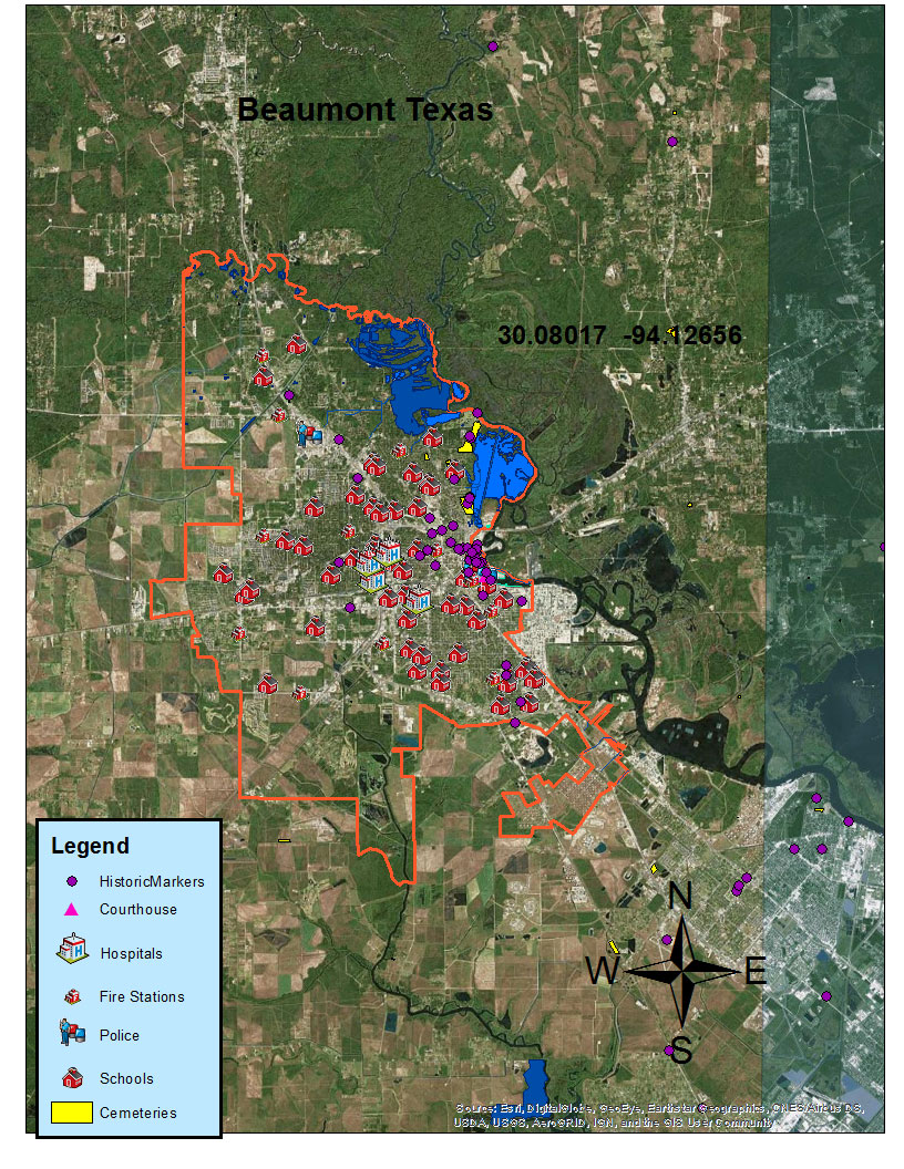
“During my deployments, I had to travel extensively to reach victims affected by these disasters, and if it were not for our current GPS systems, and available mapping tools I would not have been efficient with time management,” Rock said. After Hurricane Harvey made landfall in Texas, Gina was deployed to Beaumont, Texas, where she is training new site inspectors to assess damage to parks, roads, city hall, schools, fire stations, historical landmarks, bridges, hospitals, culverts and the removal of debris.”
“For the past two years in the USC GEOINT Graduate Certificate program, I have been taking courses learning how to use GIS, remote sensing, and geospatial intelligence. These classes allow me to learn how to use the tools in ArcGIS, and apply lessons learned to my job,” she continues.
Gina recently completed additional training at the Emergency Management Institute in Maryland where she obtained the skills to utilize the GIS FEMA floodplain maps and coordinate systems that help identify structures, roads, and debris locations. “Coordinates and maps are one of the most important tools we use when we visit the disaster sites,” she said.
Lynnette Hudson (Graduate Certificate in Geographic Information Science and Technology) based in Plano, Texas, also was called to action. “During Hurricane Harvey, I directed and coordinated a team in activities that supported public health and emergency management. Even though our county was not directly affected, we worked with our colleagues from surrounding counties,” said Hudson. Her team was instrumental in creating a resource database for the county’s partners. “We were receiving emails day and night. All of those resources had to be logged and documented as well as updated constantly.” Lynnette’s team also coordinated volunteers who were sent to work at the mega shelter that housed 5,000 displaced residents. “There were quite a few all-nighters but as the disaster moved from the response to recovery phase, I knew that the resilience within those affected would persevere. I am fortunate to have a team of high skilled and eager workers who did an amazing job.”
We’re proud of Gina and Lynnette, as well as others in the USC Spatial community who have been working on these important missions.

