
Chris Weidemann, a graduate student in the Geographic Information Science and Technology (GIST) online master’s program, won the 2014 Robert Raskin Mashup Mapping competition. Photo courtesy of Chris Weidemann.
GIST MS student Chris Weidemann took home top honors at the second annual Robert Raskin Mashup Mapping Competition sponsored by the Cyberinfrastructure specialty group of the Association of American Geographers. Chris' map provides users with a view into what he calls their "geosocial footprint" -- the digital traces that social media users leave behind embedded in their status updates.
Weidemann's tool, developed as part of his MS thesis research with advisor Dr. Jennifer Swift, is freely available at http://geosocialfootprint.com/ and gained significant media attention when first announced in a paper published by Weidemann and Swift.
The Robert Raskin Mashup Mapping Competition is designed to stimulate interest in online mapping and inspire curiosity about geographic information in a manner that is accessible to the general public. As a finalist in the competition, Weidemann traveled to the annual AAG meeting in Tampa, Florida to present his map in a panel session before the judges.
Following the presentations, Weidemann's geosocial footprint map was given first prize by the judges, ranking highest across the categories of concept and originality, cartographic design, interface design, compatibility/interoperability, and communication skills.
This is the second year that USC GIST MS students have excelled in the Raskin competition; Nancy Milholland's map of public art in San Francisco was a finalist in 2013.
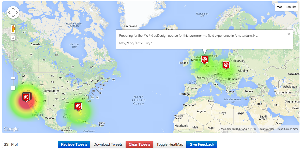
@SSI_Prof Darren Ruddell's geosocial footprint shows that he has been traveling as part of his duties at USC.

